Jump to content

File:Карта народонаселения Ковенской губернии по исповеданиям (1864).jpg

Page contents not supported in other languages.
This is a file from the Wikimedia Commons
From Wikipedia, the free encyclopedia

Original file(19,644 × 14,526 pixels, file size: 21.22 MB, MIME type: image/jpeg)

Summary

Warning The original file is very high-resolution. It might not load properly or could cause your browser to freeze when opened at full size. Open in ZoomViewer
Description
English: Map of population of the Kovno Governorate of confessions, 1864.
Українська: Мапа народонаселення Ковенської губернії за віросповіданнями, 1864 рік.
Date
Source Риттих А. Ф. Атлас народонаселения Западно-Русского края по исповеданиям / сост. при М-ве внутр. дел, в Канцелярии зав. устройством православ. церквей в зап. губерниях; [сост. А. Ф. Риттих]. – Изд. 2-е, испр. и доп. – Санкт-Петербург: Тип. В. Веллинга, 1864. – [2] с., [16] л. карт, табл. URL: Topographic Maps of Eastern Europe
Author
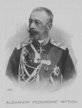
Aleksandr Fyodorovich Rittikh  (1831–1914) wikidata:Q2628054
 
Aleksandr Fyodorovich Rittikh
Description cartographer, politician, military officer, ethnographer, journalist and historian
Date of birth/death 23 June 1831 (in Julian calendar) / 1831 Edit this at Wikidata 1914 Edit this at Wikidata
Location of birth/death Russian Empire Pushkin
Authority file
creator QS:P170,Q2628054

Licensing

This is a faithful photographic reproduction of a two-dimensional, public domain work of art. The work of art itself is in the public domain for the following reason:
Public domain

This work is in the public domain in its country of origin and other countries and areas where the copyright term is the author's life plus 70 years or fewer.


You must also include a United States public domain tag to indicate why this work is in the public domain in the United States. Note that a few countries have copyright terms longer than 70 years: Mexico has 100 years, Jamaica has 95 years, Colombia has 80 years, and Guatemala and Samoa have 75 years. This image may not be in the public domain in these countries, which moreover do not implement the rule of the shorter term. Honduras has a general copyright term of 75 years, but it does implement the rule of the shorter term. Copyright may extend on works created by French who died for France in World War II (more information), Russians who served in the Eastern Front of World War II (known as the Great Patriotic War in Russia) and posthumously rehabilitated victims of Soviet repressions (more information).

The official position taken by the Wikimedia Foundation is that "faithful reproductions of two-dimensional public domain works of art are public domain".
This photographic reproduction is therefore also considered to be in the public domain in the United States. In other jurisdictions, re-use of this content may be restricted; see Reuse of PD-Art photographs for details.

Captions

Add a one-line explanation of what this file represents

Items portrayed in this file

depicts

image/jpeg

File history

Click on a date/time to view the file as it appeared at that time.

Date/TimeThumbnailDimensionsUserComment
current20:06, 23 July 2020Thumbnail for version as of 20:06, 23 July 202019,644 × 14,526 (21.22 MB)ZxcvUUploaded a work by {{creator|wikidata=Q2628054}} from Риттих А. Ф. Атлас народонаселения Западно-Русского края по исповеданиям / сост. при М-ве внутр. дел, в Канцелярии зав. устройством православ. церквей в зап. губерниях; [сост. А. Ф. Риттих]. – Изд. 2-е, испр. и доп. – Санкт-Петербург: Тип. В. Веллинга, 1864. – [2] с., [16] л. карт, табл. URL: [http://easteurotopo.org/maps/thematic-atlas-western-russia/ Topographic Maps of Eastern Europe] with UploadWizard
No pages on the English Wikipedia use this file (pages on other projects are not listed).

Global file usage

The following other wikis use this file: