
File:Algeria RASD Locator.PNG

Size of this preview: 528 × 600 pixels. Other resolutions: 211 × 240 pixels | 422 × 480 pixels | 720 × 818 pixels.
Original file (720 × 818 pixels, file size: 42 KB, MIME type: image/png)
| This is a file from the Wikimedia Commons. Information from its description page there is shown below. Commons is a freely licensed media file repository. You can help. |

|
This locator map image could be re-created using vector graphics as an SVG file. This has several advantages; see Commons:Media for cleanup for more information. If an SVG form of this image is available, please upload it and afterwards replace this template with
{{vector version available|new image name}}.
It is recommended to name the SVG file “Algeria RASD Locator.svg”—then the template Vector version available (or Vva) does not need the new image name parameter. |
Summary
| Description |
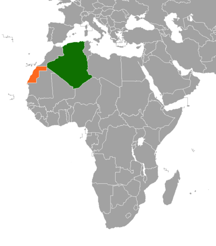
English: Locator map showing Algeria and RASD
العربية: خريطة موقع تبيّن الجزائر و ج ع ص د |
| Date | |
| Source | self-made based on Image:BlankMap-World6, compact.svg |
| Author | ترجمان05 |
Licensing
| I, the copyright holder of this work, release this work into the public domain. This applies worldwide. In some countries this may not be legally possible; if so: I grant anyone the right to use this work for any purpose, without any conditions, unless such conditions are required by law. |
File history
Click on a date/time to view the file as it appeared at that time.
| Date/Time | Thumbnail | Dimensions | User | Comment | |
|---|---|---|---|---|---|
| current | 06:24, 11 March 2021 | | 720 × 818 (42 KB) | Christian Ferrer | Reverted to version as of 03:34, 11 March 2021 (UTC) |
| 04:24, 11 March 2021 |  | 720 × 818 (28 KB) | Al.Massira | Reverted to version as of 21:41, 10 March 2021 (UTC) this is Algeria RASD Locator, not Algeria Western Sahara Locator | |
| 03:34, 11 March 2021 |  | 720 × 818 (42 KB) | Koavf | Reverted to version as of 21:28, 10 March 2021 (UTC) | |
| 21:41, 10 March 2021 |  | 720 × 818 (28 KB) | Al.Massira | Reverted to version as of 20:09, 10 March 2021 (UTC) Western Sahara is recognised by the UN as a disputed territory, not any country. Unjustified revert, putting back map showing territories controlled by RASD | |
| 21:28, 10 March 2021 |  | 720 × 818 (42 KB) | M.Bitton | Reverted to version as of 23:31, 28 December 2020 (UTC): Per COM:OVERWRITE | |
| 20:09, 10 March 2021 |  | 720 × 818 (28 KB) | Al.Massira | Polisario-controlled territories (RASD) | |
| 20:09, 10 March 2021 |  | 355 × 297 (28 KB) | Al.Massira | Reverted to version as of 10:22, 10 August 2008 (UTC) briefly reverting to upload new file | |
| 23:31, 28 December 2020 |  | 720 × 818 (42 KB) | Aquintero82 | Updated map | |
| 10:22, 10 August 2008 |  | 355 × 297 (28 KB) | ترجمان05 | {{Information |Description={{en|1=Locator map showing Algeria and RASD }} {{ar|1=خريطة موقع تبيّن الجزائر و ج ع ص د}} |Source=self-made based on Image:BlankMap-World6, compact.svg |Author=ترجمان05 |Date=2008-08-10 |Permiss |
File usage
The following pages on the English Wikipedia use this file (pages on other projects are not listed):
Global file usage
The following other wikis use this file:
- Usage on ar.wikipedia.org
- Usage on es.wikipedia.org
- Usage on fr.wikipedia.org
- Usage on he.wikipedia.org
- Usage on ru.wikipedia.org
- Usage on www.wikidata.org
- Usage on zh.wikipedia.org