
File:Alter Orient.PNG

Size of this preview: 800 × 370 pixels. Other resolutions: 320 × 148 pixels | 640 × 296 pixels | 1,357 × 628 pixels.
Original file (1,357 × 628 pixels, file size: 18 KB, MIME type: image/png)
| This is a file from the Wikimedia Commons. Information from its description page there is shown below. Commons is a freely licensed media file repository. You can help. |
Summary
| Description |
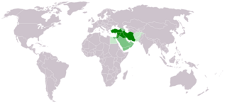
Deutsch: Karte des Alten Orients (Kern-/Peripheriegebiete farblich abgesetzt) |
| Date | |
| Source | File:LocationWestAsia.PNG |
| Author | Schar Kischschatim |
Licensing
| I, the copyright holder of this work, release this work into the public domain. This applies worldwide. In some countries this may not be legally possible; if so: I grant anyone the right to use this work for any purpose, without any conditions, unless such conditions are required by law. |
File history
Click on a date/time to view the file as it appeared at that time.
| Date/Time | Thumbnail | Dimensions | User | Comment | |
|---|---|---|---|---|---|
| current | 06:38, 26 September 2022 | | 1,357 × 628 (18 KB) | Рагин1987 | Small correction |
| 17:43, 30 May 2010 |  | 1,357 × 628 (45 KB) | Schar Kischschatim | {{Information |Description={{de|1=Karte des Alten Orients}} |Source=File:LocationWestAsia.PNG |Author=Schar Kischschatim |Date=Mai 30th 2010 |Permission= |other_versions= }} Category:Maps of West Asia [[Category:Maps |
File usage
The following pages on the English Wikipedia use this file (pages on other projects are not listed):
Global file usage
The following other wikis use this file:
- Usage on als.wikipedia.org
- Usage on ar.wikipedia.org
- Usage on bg.wikipedia.org
- Usage on de.wikipedia.org
- Usage on fr.wikipedia.org
- Usage on hu.wikipedia.org