
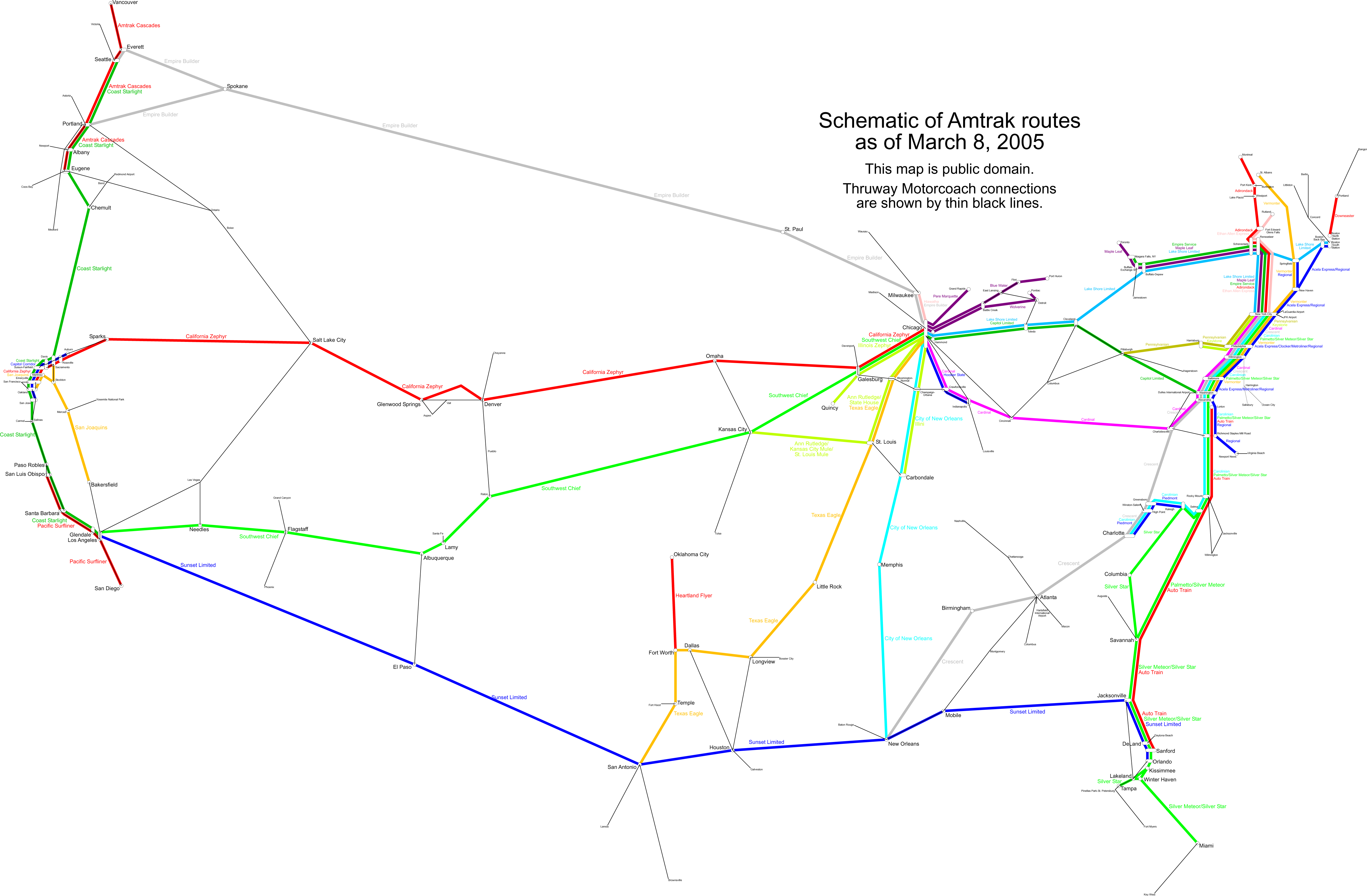
File:Amtrak schematic.png
Size of this preview: 800 × 524 pixels. Other resolutions: 320 × 210 pixels | 640 × 420 pixels | 1,024 × 671 pixels | 1,280 × 839 pixels | 2,560 × 1,678 pixels | 5,165 × 3,386 pixels.
Original file (5,165 × 3,386 pixels, file size: 686 KB, MIME type: image/png)
| This is a file from the Wikimedia Commons. Information from its description page there is shown below. Commons is a freely licensed media file repository. You can help. |
| Description | Schematic of Amtrak routes as of March 2005 |
| Date | |
| Source | Own work |
| Author | User:SPUI |
| This work has been released into the public domain by its author, SPUI. This applies worldwide. In some countries this may not be legally possible; if so: |
File history
Click on a date/time to view the file as it appeared at that time.
| Date/Time | Thumbnail | Dimensions | User | Comment | |
|---|---|---|---|---|---|
| current | 21:27, 8 May 2005 | | 5,165 × 3,386 (686 KB) | Berkut~commonswiki | compressed |
| 12:11, 25 March 2005 |  | 5,165 × 3,386 (908 KB) | SPUI~commonswiki | The truncated Three Rivers is the Pennsylvanian. | |
| 23:53, 8 March 2005 |  | 5,165 × 3,386 (908 KB) | SPUI~commonswiki | new map with truncation of the Three Rivers | |
| 01:17, 10 January 2005 |  | 5,165 × 3,386 (430 KB) | SPUI~commonswiki | {{spuimap}} A w:schematic of the w:Amtrak routes as of mid-December 2004. Drawn by User:SPUI using public domain maps for a base. |
File usage
The following page uses this file: