
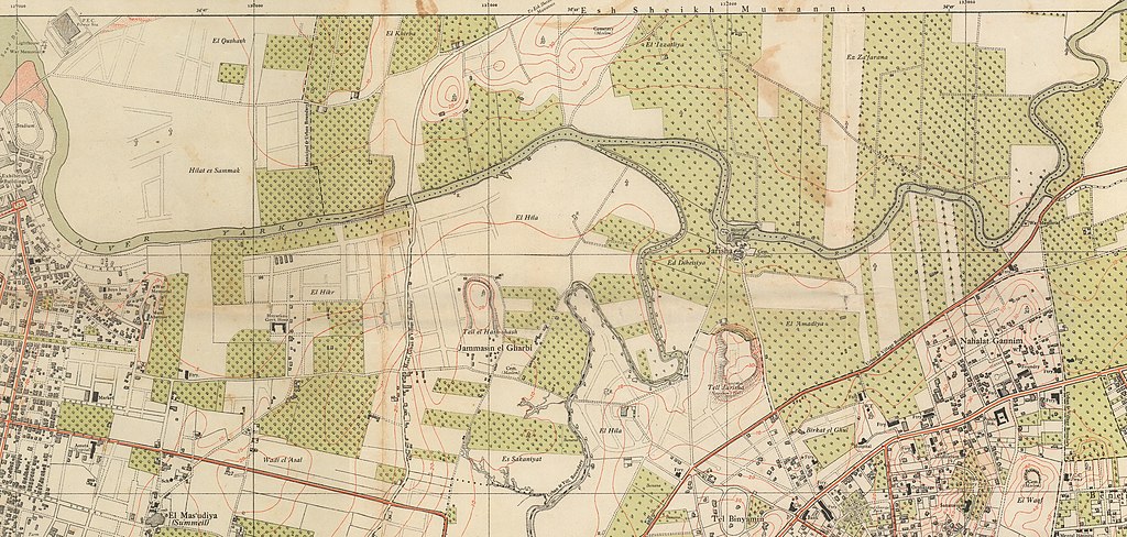
File:Area of Modern Yarkon Park, as shown in the Map Jaffa Tel Aviv Compiled, drawn and printed by the Survey of Palestine 1944 2366983 (cropped).jpg

Size of this preview: 800 × 381 pixels. Other resolutions: 320 × 152 pixels | 640 × 305 pixels | 1,024 × 488 pixels | 1,280 × 609 pixels | 2,560 × 1,219 pixels | 5,589 × 2,661 pixels.
Original file (5,589 × 2,661 pixels, file size: 3.42 MB, MIME type: image/jpeg)
| This is a file from the Wikimedia Commons. Information from its description page there is shown below. Commons is a freely licensed media file repository. You can help. |
Summary
| Description |
English: Map of Jaffa - Tel Aviv; Compiled, drawn & printed by the Survey of Palestine 1944
עברית: מפת יפו-תל אביב, נוצרה ב- 1944 ע"י Survey of Palestine |
|||
| Date | ||||
| Source |
|
|||
| Author | Survey of Palestine | |||
| Other versions |


.jpg)
Licensing
This work created by the United Kingdom Government is in the public domain.
This is because it is one of the following:
HMSO has declared that the expiry of Crown Copyrights applies worldwide (ref: HMSO Email Reply)
|
 |
File history
Click on a date/time to view the file as it appeared at that time.
| Date/Time | Thumbnail | Dimensions | User | Comment | |
|---|---|---|---|---|---|
| current | 04:00, 23 April 2022 | | 5,589 × 2,661 (3.42 MB) | Onceinawhile | File:Map Jaffa Tel Aviv Compiled, drawn and printed by the Survey of Palestine 1944 2366983.jpg cropped 39 % horizontally, 65 % vertically using CropTool with precise mode. |
File usage
The following pages on the English Wikipedia use this file (pages on other projects are not listed):
.jpg)