
File:Army Map Service Kodaikanal City.jpg

Size of this preview: 800 × 404 pixels. Other resolutions: 320 × 162 pixels | 640 × 323 pixels | 1,015 × 513 pixels.
Original file (1,015 × 513 pixels, file size: 792 KB, MIME type: image/jpeg)
| This is a file from the Wikimedia Commons. Information from its description page there is shown below. Commons is a freely licensed media file repository. You can help. |
Summary
| Description |
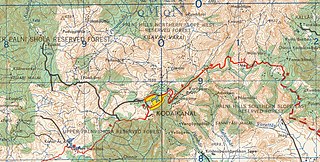
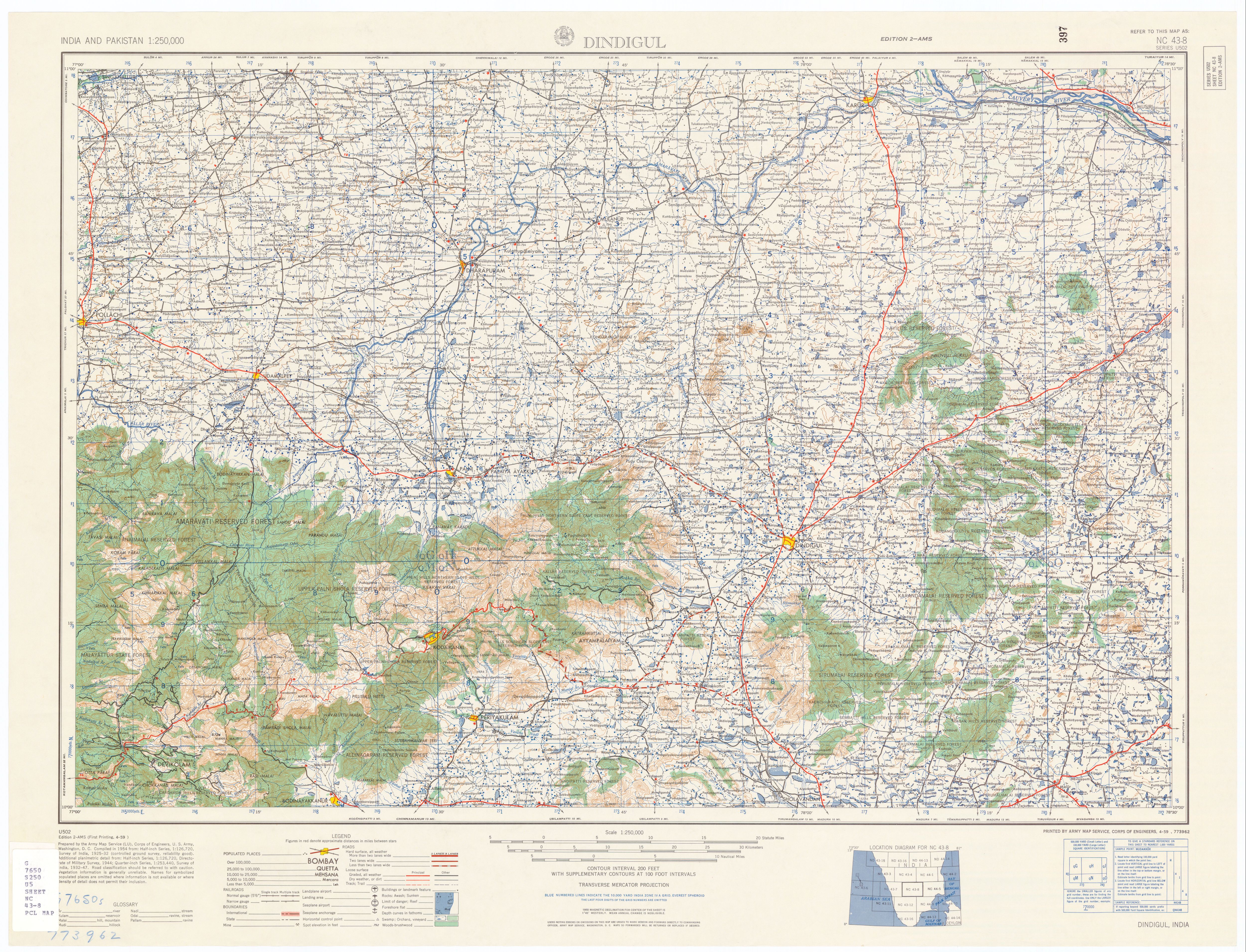
English: Map, Topo, Kodaikanal City, Tamil Nadu, India |
| Date | |
| Source | U.S. Army Topology Command |
| Author | U.S. Army Map Service |
| Permission (Reusing this file) |
Public Domain |
| Other versions | http://www.lib.utexas.edu/maps/ams/india/nc-43-08.jpg , http://www.lib.utexas.edu/maps/ams/india/ |
Licensing
This file is a work of a U.S. Army soldier or employee, taken or made as part of that person's official duties. As a work of the U.S. federal government, it is in the public domain in the United States.
|
 |
File history
Click on a date/time to view the file as it appeared at that time.
| Date/Time | Thumbnail | Dimensions | User | Comment | |
|---|---|---|---|---|---|
| current | 15:32, 14 April 2007 | | 1,015 × 513 (792 KB) | Marcus334 | {{Information |Description=Map, Topo, Kodaikanal City, Tamil Nadu, India |Source=U.S. Army Topology Command |Date=1955 |Author=U.S. Army Map Service |Permission=Public Domain |other_versions= http://www.lib.utexas.edu/maps/ams/india/nc-43-08.jpg , http:// |
File usage
The following pages on the English Wikipedia use this file (pages on other projects are not listed):