
File:Assassination attempt of Donald Trump diagram.svg

Original file (SVG file, nominally 793 × 753 pixels, file size: 20 KB)
| This is a file from the Wikimedia Commons. Information from its description page there is shown below. Commons is a freely licensed media file repository. You can help. |
Summary
| Description |
العربية: مخطط يظهر أماكن تواجد منفذ الهجوم توامس ماثيو كروكس (اللون الأحمر)، ودونالد ترامب (اللون الأسود)، وفرقة مكافحة الاعتداء للخدمة السرية (اللون الأزرق) خلال محاولة اغتيال ترامب في يوليو 2024
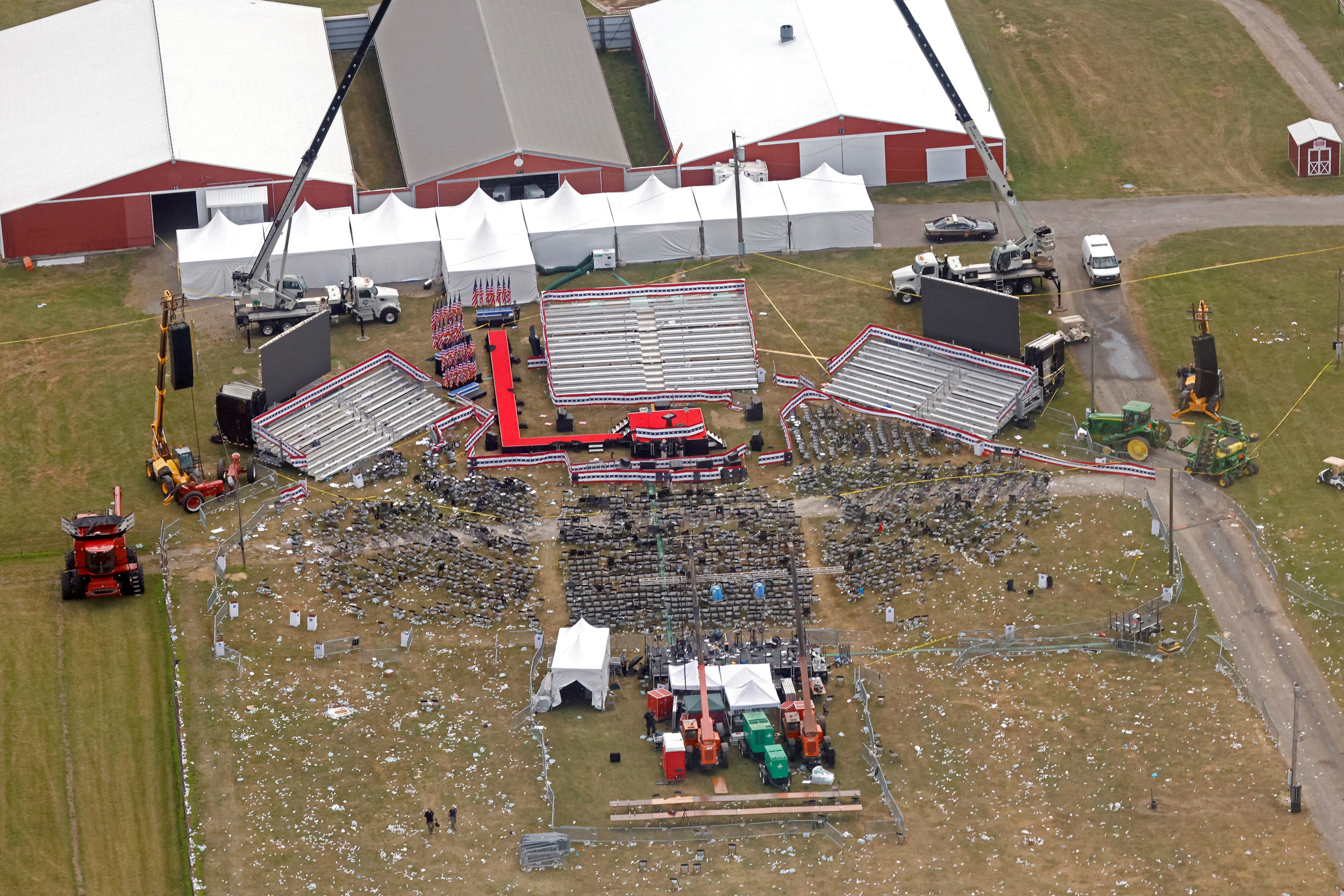
English: A diagram illustrating the approximate locations of Thomas Matthew Crooks (red), Donald Trump (black), and the Secret Service Counter Assault Team (blue) during the attempted assassination of Donald Trump in July 2024
Français : Un diagramme illustrant les emplacements approximatifs de Thomas Matthew Crooks (rouge), Donald Trump (noir) et l'équipe de contre-embuscade (E.C.E) du Secret Service (bleu)
Nederlands: Plattegrond van de bijeenkomst tijdens de moordpoging van Donald Trump met geschatte locaties van Trump (zwart), Crooks (rood), en de tegenaanvalteam van de geheime dienst (SSCAT) (blauw) |
|||
| SVG development | ||||
| Date | ||||
| Source | openstreetmap.org | |||
| Creator |
OpenStreetMap contributors |
|||
| Permission (Reusing this file) |
OpenStreetMap data is available under the Open Database License (details). Standard style map tiles are licensed as ODbL Produced Works.
|
|||
| Georeferencing | If inappropriate please set warp_status = skip to hide. |
References
Sources of labeled locations:[1][2][3]
Location of another CAT on second building:[4]
Location of victims:[5]
Approximate measurements of stage, bleachers, and seats:[6][7]
- ↑ (2024-07-13). "Shooting at a Trump Rally in Pennsylvania: Maps and Photos". The New York Times. ISSN 0362-4331.
- ↑ Trump injured, rushed from stage after shooter fired on his Pennsylvania rally (in en). NBC News (2024-07-13). Archived from the original on July 14, 2024. Retrieved on 2024-07-14.
- ↑ Sky News (2024-07-14). Trump shooting: Gunman identified as video shows body and rifle on roof. Sky News. Retrieved on 2024-07-15.
- ↑ The Wall Street Journal (2024-07-14). How Donald Trump’s Attempted Assassination Unfolded. YouTube. Retrieved on 2024-07-14.
- ↑ Storyful News & Weather (2024-07-14). Bloodied Person Carried Away From Stands Following Shooting at Trump Rally. YouTube. Retrieved on 2024-07-15.
- ↑ Aerial footage of scene after shooting at Trump rally in Butler, Pennsylvania. WFXG FOX54 (2024-07-13). Retrieved on 2024-07-14.
- ↑ https://media-cldnry.s-nbcnews.com/image/upload/q_auto:best/rockcms/2024-07/240714-donald-trump-butler-rally-shooting-aftermath-wm-129p-6af977.jpg
Licensing
| This work contains information from OpenStreetMap, which is made available under the Open Database License (ODbL).
The ODbL does not require any particular license for maps produced from ODbL data. Prior to 1 August 2020, map tiles produced by the OpenStreetMap Foundation were licensed under the CC-BY-SA-2.0 license. Maps produced by other people may be subject to other licences. |
File history
Click on a date/time to view the file as it appeared at that time.
| Date/Time | Thumbnail | Dimensions | User | Comment | |
|---|---|---|---|---|---|
| current | 11:40, 15 July 2024 | | 793 × 753 (20 KB) | BmboB | Updated |
| 06:02, 15 July 2024 |  | 512 × 637 (19 KB) | أنون | File uploaded using svgtranslate tool (https://svgtranslate.toolforge.org/). Added translation for ar. | |
| 04:01, 15 July 2024 |  | 512 × 637 (18 KB) | Glrx | remove some paint-order; add second dot for CAT | |
| 21:42, 14 July 2024 |  | 512 × 637 (18 KB) | Ђидо | File uploaded using svgtranslate tool (https://svgtranslate.toolforge.org/). Added translation for sr-cyrl. | |
| 20:53, 14 July 2024 |  | 512 × 637 (18 KB) | Pottero | File uploaded using svgtranslate tool (https://svgtranslate.toolforge.org/). Added translation for pl. | |
| 18:00, 14 July 2024 |  | 512 × 637 (17 KB) | Glrx | fix duped ids | |
| 17:56, 14 July 2024 |  | 512 × 637 (17 KB) | Glrx | don't stroke text in scale | |
| 17:45, 14 July 2024 |  | 512 × 637 (17 KB) | Glrx | delete unref'd clipPath; add clipPath; delete width, height on svg element | |
| 17:33, 14 July 2024 |  | 638 × 793 (17 KB) | Glrx | +en; promote formating to switch | |
| 16:42, 14 July 2024 |  | 638 × 793 (21 KB) | Minwuekim | File uploaded using svgtranslate tool (https://svgtranslate.toolforge.org/). Added translation for ko. |
File usage
Global file usage
The following other wikis use this file:
- Usage on be-tarask.wikipedia.org
- Usage on ca.wikipedia.org
- Usage on cy.wikipedia.org
- Usage on el.wikipedia.org
- Usage on es.wikipedia.org
- Usage on et.wikipedia.org
- Usage on fi.wikipedia.org
- Usage on ga.wikipedia.org
- Usage on hu.wikipedia.org
- Usage on id.wikipedia.org
- Usage on it.wikipedia.org
- Usage on ja.wikipedia.org
- Usage on kk.wikipedia.org
- Usage on ko.wikipedia.org
- Usage on nl.wikipedia.org
- Usage on pl.wikipedia.org
- Usage on pt.wikipedia.org
- Usage on sd.wikipedia.org
- Usage on sr.wikipedia.org
- Usage on th.wikipedia.org
- Usage on tr.wikipedia.org
- Usage on www.wikidata.org