
File:BakerIsland.jpeg

Size of this preview: 800 × 455 pixels. Other resolutions: 320 × 182 pixels | 640 × 364 pixels | 1,024 × 583 pixels | 1,280 × 728 pixels | 2,100 × 1,195 pixels.
Original file (2,100 × 1,195 pixels, file size: 454 KB, MIME type: image/jpeg)
| This is a file from the Wikimedia Commons. Information from its description page there is shown below. Commons is a freely licensed media file repository. You can help. |
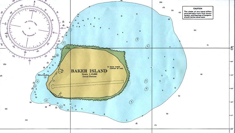
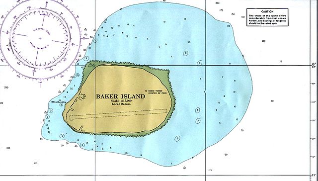
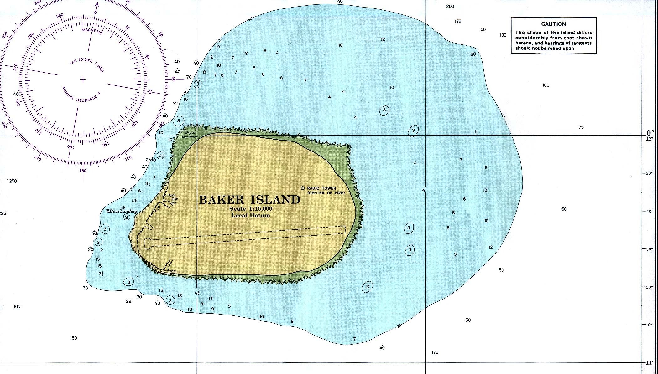
Baker Island
Modified from PCL map collection
- Baker_island_86.jpg. Nautical chart, original 1:15000 produced by NOAA, 1978. Subsequent revision: 1986.
- [1] archive copy at the Wayback Machine higher resolution version
![[1]](http://images.nationmaster.com/images/motw/islands_oceans_poles/baker_island_86.jpg)
This image is in the public domain because it contains materials that originally came from the U.S. National Oceanic and Atmospheric Administration, taken or made as part of an employee's official duties.
|
{{]vector version available|Baker Island.svg}}
File history
Click on a date/time to view the file as it appeared at that time.
| Date/Time | Thumbnail | Dimensions | User | Comment | |
|---|---|---|---|---|---|
| current | 19:50, 22 October 2016 | | 2,100 × 1,195 (454 KB) | Ratzer | higher resolution, etc. |
| 21:41, 25 November 2006 |  | 384 × 288 (26 KB) | Electionworld | Baker Island Modified from [http://www.lib.utexas.edu/maps/index.html PCL map collection] * [http://www.lib.utexas.edu/maps/islands_oceans_poles/baker_island_86.jpg Baker_island_86.jpg]. Nautical chart, original 1:15000 produced by NOAA, 1978. Subsequen |
File usage
No pages on the English Wikipedia use this file (pages on other projects are not listed).
Global file usage
The following other wikis use this file:
- Usage on eo.wikipedia.org
- Usage on he.wikipedia.org
- Usage on lij.wikipedia.org
- Usage on sh.wikipedia.org