
File:Barking Woods at Titley Hill - geograph.org.uk - 314714.jpg
No higher resolution available.
Barking_Woods_at_Titley_Hill_-_geograph.org.uk_-_314714.jpg (640 × 427 pixels, file size: 64 KB, MIME type: image/jpeg)
| This is a file from the Wikimedia Commons. Information from its description page there is shown below. Commons is a freely licensed media file repository. You can help. |
Summary
| Description |
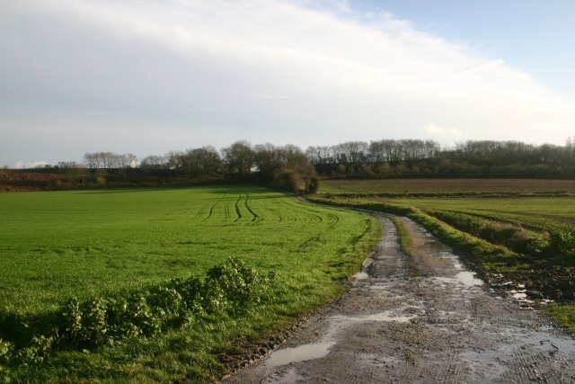
English: Barking Woods at Titley Hill Barking Woods is a Site of Special Scientific Interest. The area is an inter-related group of ancient woodlands, whose history has been well documented since 1251. The majority of the medieval earthbanks still remain and are marked by large pollards of oak and ash. The woodland structure is predominantly coppice-with-standards, composed of a variety of different stand-types. |
| Date | |
| Source | From geograph.org.uk |
| Author | Bob Jones |
| Attribution (required by the license) | Bob Jones / Barking Woods at Titley Hill / |
| Camera location | | View this and other nearby images on: OpenStreetMap |
|---|
_heading:135.00&language=en)
| Object location | | View this and other nearby images on: OpenStreetMap |
|---|
_heading:135.00&language=en)
Licensing

|
This image was taken from the Geograph project collection. See this photograph's page on the Geograph website for the photographer's contact details. The copyright on this image is owned by Bob Jones and is licensed for reuse under the Creative Commons Attribution-ShareAlike 2.0 license.
|
This file is licensed under the Creative Commons Attribution-Share Alike 2.0 Generic license.
Attribution: Bob Jones
- You are free:
- to share – to copy, distribute and transmit the work
- to remix – to adapt the work
- Under the following conditions:
- attribution – You must give appropriate credit, provide a link to the license, and indicate if changes were made. You may do so in any reasonable manner, but not in any way that suggests the licensor endorses you or your use.
- share alike – If you remix, transform, or build upon the material, you must distribute your contributions under the same or compatible license as the original.
File history
Click on a date/time to view the file as it appeared at that time.
| Date/Time | Thumbnail | Dimensions | User | Comment | |
|---|---|---|---|---|---|
| current | 14:29, 30 December 2010 | | 640 × 427 (64 KB) | GeographBot | == {{int:filedesc}} == {{Information |description={{en|1=Barking Woods at Titley Hill Barking Woods is a Site of Special Scientific Interest. The area is an inter-related group of ancient woodlands, whose history has been well documented since 1251. The |
File usage
The following pages on the English Wikipedia use this file (pages on other projects are not listed):
Global file usage
The following other wikis use this file:
- Usage on www.wikidata.org