
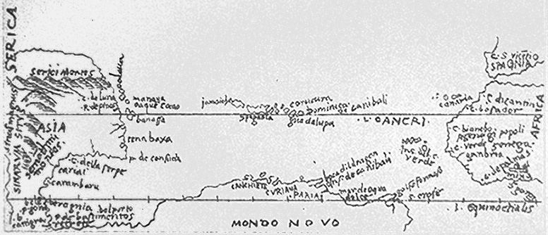
File:Bartolomeo Columbus map, West Indies.jpg
No higher resolution available.
Bartolomeo_Columbus_map,_West_Indies.jpg (776 × 334 pixels, file size: 142 KB, MIME type: image/jpeg)
| This is a file from the Wikimedia Commons. Information from its description page there is shown below. Commons is a freely licensed media file repository. You can help. |
Summary
| Description | Bartolomeo Columbus map of the West Indies (1506) |
| Date | Map ~1506; Image file unknown |
| Source | http://www.henry-davis.com/MAPS/Ren/Ren1/304.html |
| Author | Map Bartolomeo Columbus/Alessandro Zorzi; File unknown |
| Permission (Reusing this file) |
none; reproduction of public domain work (due to age) |
Licensing
|
This work is in the public domain in its country of origin and other countries and areas where the copyright term is the author's life plus 70 years or fewer. | |
| This file has been identified as being free of known restrictions under copyright law, including all related and neighboring rights. | |
File history
Click on a date/time to view the file as it appeared at that time.
| Date/Time | Thumbnail | Dimensions | User | Comment | |
|---|---|---|---|---|---|
| current | 23:35, 14 October 2006 | | 776 × 334 (142 KB) | Gribeco | {{Information |Description=Bartolomeo Columbus map of the West Indies (1506) |Source=http://www.henry-davis.com/MAPS/Ren/Ren1/304.html |Date=Map ~1506; Image file unknown |Author=Map Bartolomeo Columbus/Alessandro Zorzi; File unknown |Permission=none; rep |
File usage
The following page uses this file:
Global file usage
The following other wikis use this file:
- Usage on ca.wikipedia.org
- Usage on eo.wikipedia.org
- Usage on es.wikipedia.org
- Usage on fr.wikipedia.org
- Usage on gl.wikipedia.org
- Usage on sh.wikipedia.org
- Usage on www.wikidata.org