
File:Bengal map 1893.JPG
Size of this preview: 480 × 599 pixels. Other resolutions: 192 × 240 pixels | 384 × 480 pixels | 615 × 768 pixels | 1,063 × 1,327 pixels.
Original file (1,063 × 1,327 pixels, file size: 396 KB, MIME type: image/jpeg)
| This is a file from the Wikimedia Commons. Information from its description page there is shown below. Commons is a freely licensed media file repository. You can help. |
Summary
| Description |
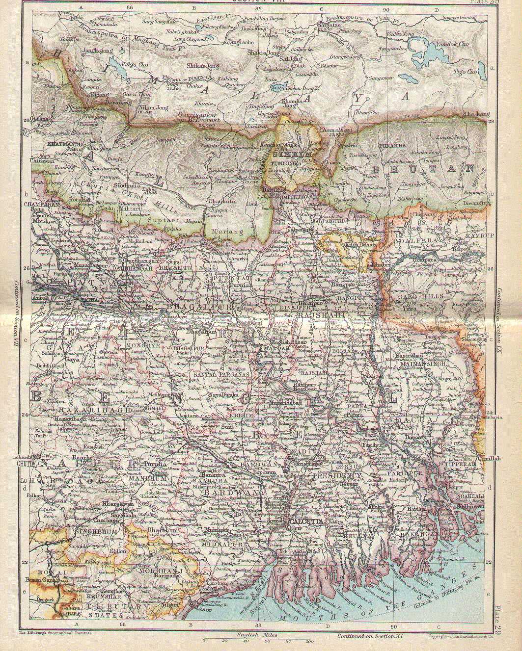
English: 1893 map of Bengal |
|||||||||
| Date | ||||||||||
| Source | Here | |||||||||
| Creator |
John Bartholomew |
|||||||||
| Permission (Reusing this file) |
This image is in the public domain due to its age. | |||||||||
| Geotemporal data | ||||||||||
| Bounding box |
|
|||||||||
| Georeferencing | ||||||||||
Licensing
|
This work is in the public domain in its country of origin and other countries and areas where the copyright term is the author's life plus 70 years or fewer. | |
| This file has been identified as being free of known restrictions under copyright law, including all related and neighboring rights. | |
|
This work is in the public domain in its country of origin and other countries and areas where the copyright term is the author's life plus 100 years or fewer. This work is in the public domain in the United States because it was published (or registered with the U.S. Copyright Office) before January 1, 1929. | |
| This file has been identified as being free of known restrictions under copyright law, including all related and neighboring rights. | |
| Annotations | This image is annotated: View the annotations at Commons |
File history
Click on a date/time to view the file as it appeared at that time.
| Date/Time | Thumbnail | Dimensions | User | Comment | |
|---|---|---|---|---|---|
| current | 03:54, 11 April 2006 | | 1,063 × 1,327 (396 KB) | Roke~commonswiki | map from [http://homepages.rootsweb.com/~poyntz/India/maps.html] {{PD-old}} Category: Bengal |
File usage
The following pages on the English Wikipedia use this file (pages on other projects are not listed):
Global file usage
The following other wikis use this file:
- Usage on be.wikipedia.org
- Usage on fi.wikipedia.org
- Usage on incubator.wikimedia.org
- Usage on it.wikipedia.org
- Usage on kn.wikipedia.org
- Usage on pnb.wikipedia.org
- Usage on ru.wikipedia.org
- Usage on sq.wikipedia.org
- Usage on ta.wikipedia.org
- Usage on uk.wikipedia.org
- Usage on ur.wikipedia.org