
File:BlueDome.jpg

Size of this preview: 800 × 547 pixels. Other resolutions: 320 × 219 pixels | 640 × 438 pixels | 873 × 597 pixels.
Original file (873 × 597 pixels, file size: 51 KB, MIME type: image/jpeg)
| This is a file from the Wikimedia Commons. Information from its description page there is shown below. Commons is a freely licensed media file repository. You can help. |
|
This is an image of a place or building that is listed on the National Register of Historic Places in the United States of America. Its reference number is 11000895. |
Summary
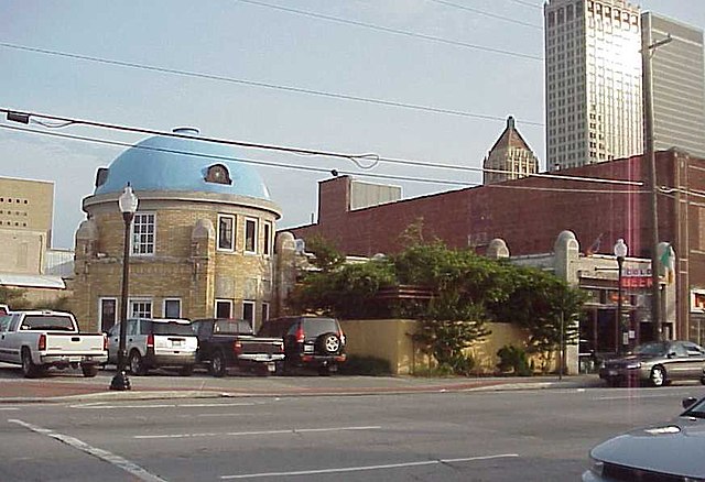
| Description | The Blue Dome, a former Gulf Oil Service Station, built in 1924. Now houses bar. |
| Date | |
| Source | Own work |
| Author | David Stapleton (Dsmdgold) |
| Object location | | View this and other nearby images on: OpenStreetMap |
|---|
Licensing
I, Dsmdgold, the copyright holder of this work, hereby publishes it under the following licenses:

|
Permission is granted to copy, distribute and/or modify this document under the terms of the GNU Free Documentation License, Version 1.2 or any later version published by the Free Software Foundation; with no Invariant Sections, no Front-Cover Texts, and no Back-Cover Texts. A copy of the license is included in the section entitled GNU Free Documentation License. |
| This file is licensed under the Creative Commons Attribution-Share Alike 3.0 Unported license. | ||
| Attribution: I, Dsmdgold | ||
| ||
| This licensing tag was added to this file as part of the GFDL licensing update. |
You may select the license of your choice.
File history
Click on a date/time to view the file as it appeared at that time.
| Date/Time | Thumbnail | Dimensions | User | Comment | |
|---|---|---|---|---|---|
| current | 04:17, 21 June 2007 | | 873 × 597 (51 KB) | Dsmdgold | {{Information |Description=The Blue Dome, a former Gulf Oil Service Station, built in 1924. Now houses bar. |Source=self-made |Date=6-20-07 |Author= David Stapleton (Dsmdgold) }} |
File usage
The following pages on the English Wikipedia use this file (pages on other projects are not listed):