Jump to content

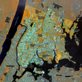
File:Bronx-NY-Landuse-Parks.png

Page contents not supported in other languages.
This is a file from the Wikimedia Commons
From Wikipedia, the free encyclopedia

Original file(2,480 × 2,480 pixels, file size: 3.38 MB, MIME type: image/png)

Summary

Description
English: Land use in the Bronx, NY with major parks identified

CRS: EPSG:32618 - WGS 84 / UTM zone 18N, in meters with X min: 586466.793, Y min: 4513895.990; X max: 603350.163, Y max: 4530779.360

Land use from Landsat 9 OLI/TIRS Collection 2 Level-1 from USGS EROS (https://www.usgs.gov/centers/eros) doi:10.5066/P9OGBGM6

acquisition 2022-05-26; path = 013; row = 032
Date
Source Own work, Landsat 9 from USGS EROS, "Parks Properties" from NYC OpenData; Shorelines "NYS Civil Boundaries" from Open-NY and "County Boundaries of NJ" from Bureau of GIS, Department of Environmental Protection, State of New Jersey
Creator
 Geotemporal data
Bounding box
N: 40.9190156°N
W: 73.9721053°W E: 73.7561026°W
S: 40.7679808°N
Georeferencing Georeference the map in Wikimaps Warper If inappropriate please set warp_status = skip to hide.
Other versions


Licensing

I, the copyright holder of this work, hereby publish it under the following license:
w:en:Creative Commons
attribution share alike
This file is licensed under the Creative Commons Attribution-Share Alike 4.0 International license.
You are free:
  • to share – to copy, distribute and transmit the work
  • to remix – to adapt the work
Under the following conditions:
  • attribution – You must give appropriate credit, provide a link to the license, and indicate if changes were made. You may do so in any reasonable manner, but not in any way that suggests the licensor endorses you or your use.
  • share alike – If you remix, transform, or build upon the material, you must distribute your contributions under the same or compatible license as the original.

Captions

Major Parks in the Bronx, NY

Items portrayed in this file

depicts

image/png

cc3c09b3cd52415dd67ac18844be646d298079b7

3,541,940 byte

2,480 pixel

2,480 pixel

File history

Click on a date/time to view the file as it appeared at that time.

Date/TimeThumbnailDimensionsUserComment
current14:29, 28 June 2022Thumbnail for version as of 14:29, 28 June 20222,480 × 2,480 (3.38 MB)DutchTreatImprove readabability of labels, add label for Brother and Rikers Islands
12:58, 26 June 2022Thumbnail for version as of 12:58, 26 June 20222,480 × 2,480 (3.26 MB)DutchTreatadjust sat image contrast and blue color band, additional river labels, add Crotona and Soundview Parks, Orchard Beach
11:08, 10 June 2022Thumbnail for version as of 11:08, 10 June 20222,480 × 2,480 (2.65 MB)DutchTreatUploaded own work with UploadWizard
The following pages on the English Wikipedia use this file (pages on other projects are not listed):

Metadata