
File:Cemaes Rural District.png
Size of this preview: 654 × 599 pixels. Other resolutions: 262 × 240 pixels | 524 × 480 pixels | 838 × 768 pixels | 1,087 × 996 pixels.
Original file (1,087 × 996 pixels, file size: 14 KB, MIME type: image/png)
| This is a file from the Wikimedia Commons. Information from its description page there is shown below. Commons is a freely licensed media file repository. You can help. |
Summary
| Description |
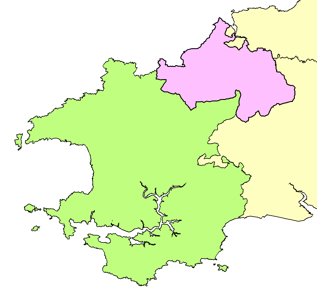
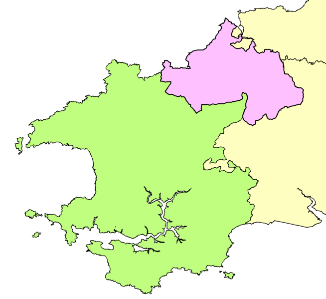
English: Map showing location of Cemaes Rural District, Pembrokeshire, Wales |
| Date | 13 September 2016 (original upload date) |
| Source | File:StDogmellsRD.png, File:LlanfyrnachRD.png |
| Author | en:User:AxG |
Licensing
| This work has been released into the public domain by its author, AxG at English Wikipedia. This applies worldwide. In some countries this may not be legally possible; if so: AxG grants anyone the right to use this work for any purpose, without any conditions, unless such conditions are required by law. |
File history
Click on a date/time to view the file as it appeared at that time.
| Date/Time | Thumbnail | Dimensions | User | Comment | |
|---|---|---|---|---|---|
| current | 20:20, 13 September 2016 | | 1,087 × 996 (14 KB) | AxG | {{Information |Description={{en|Map showing location of Cemaes Rural District, Pembrokeshire, Wales}} |Source=File:StDogmellsRD.png, File:LlanfyrnachRD.png |Date={{original upload date|2016-09-13 |Author=en:User:AxG |Permission= |other_v... |
File usage
The following pages on the English Wikipedia use this file (pages on other projects are not listed):