
File:Cerro Galan Landsat 8.jpg

Size of this preview: 701 × 600 pixels. Other resolutions: 281 × 240 pixels | 561 × 480 pixels | 898 × 768 pixels | 1,197 × 1,024 pixels | 2,259 × 1,933 pixels.
Original file (2,259 × 1,933 pixels, file size: 3.72 MB, MIME type: image/jpeg)
| This is a file from the Wikimedia Commons. Information from its description page there is shown below. Commons is a freely licensed media file repository. You can help. |
| Description |
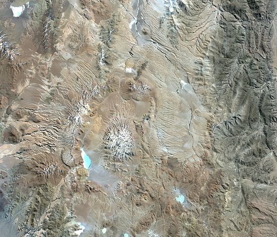
Русский: Спутниковый снимок вулкана Серро-Галан. Снимок спутника Landsat 8, обработка в ArcMap 10.2 |
|||
| Date | ||||
| Source | http://earthexplorer.usgs.gov/metadata/4923/LC82320782015133LGN00/ | |||
| Author | en:USGS | |||
| Permission (Reusing this file) |
|
| Annotations | This image is annotated: View the annotations at Commons |
File history
Click on a date/time to view the file as it appeared at that time.
| Date/Time | Thumbnail | Dimensions | User | Comment | |
|---|---|---|---|---|---|
| current | 13:56, 25 June 2015 | | 2,259 × 1,933 (3.72 MB) | Dima st bk | {{Information |Description= {{ru|Спутниковый снимок вулкана Серро-Галан. Снимок спутника Landsat 8, обработка в ArcMap 10.2}} |Source= http://earthexplorer.usgs.gov/metadata/4923/LC8232078201513... |
File usage
The following pages on the English Wikipedia use this file (pages on other projects are not listed):
Global file usage
The following other wikis use this file:
- Usage on arz.wikipedia.org
- Usage on ceb.wikipedia.org
- Usage on el.wikipedia.org
- Usage on eo.wikipedia.org
- Usage on es.wikipedia.org
- Usage on fa.wikipedia.org
- Usage on fr.wikipedia.org
- Usage on lld.wikipedia.org
- Usage on pl.wikipedia.org
- Usage on pt.wikipedia.org
- Usage on ru.wikipedia.org
- Usage on uk.wikipedia.org
- Usage on www.wikidata.org