
File:Church of St Peter and St Paul, Borden - geograph.org.uk - 655985.jpg
No higher resolution available.
Church_of_St_Peter_and_St_Paul,_Borden_-_geograph.org.uk_-_655985.jpg (640 × 444 pixels, file size: 157 KB, MIME type: image/jpeg)
| This is a file from the Wikimedia Commons. Information from its description page there is shown below. Commons is a freely licensed media file repository. You can help. |
Summary
| Description |
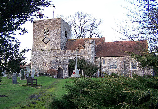
English: Church of St Peter and St Paul, Borden Supposed to have been erected about the year 1005, comprises three aisles and three chancels, with a square tower at the western end. There are some Roman bricks mixed with the flint stones in the building, and cemented with mortar in the composition of which pulverized cockle-shells have been used.
From: 'Bonchurch - Borden', A Topographical Dictionary of England (1848), pp. 302-305. URL: http://www.british-history.ac.uk/report.aspx?compid=50812. Date accessed: 12 January 2008. |
| Date | |
| Source | From geograph.org.uk |
| Author | Richard Dorrell |
| Attribution (required by the license) | Richard Dorrell / Church of St Peter and St Paul, Borden / |
| Camera location | | View this and other nearby images on: OpenStreetMap |
|---|
_heading:0.00&language=en)
| Object location | | View this and other nearby images on: OpenStreetMap |
|---|
_heading:0.00&language=en)
Licensing

|
This image was taken from the Geograph project collection. See this photograph's page on the Geograph website for the photographer's contact details. The copyright on this image is owned by Richard Dorrell and is licensed for reuse under the Creative Commons Attribution-ShareAlike 2.0 license.
|
This file is licensed under the Creative Commons Attribution-Share Alike 2.0 Generic license.
Attribution: Richard Dorrell
- You are free:
- to share – to copy, distribute and transmit the work
- to remix – to adapt the work
- Under the following conditions:
- attribution – You must give appropriate credit, provide a link to the license, and indicate if changes were made. You may do so in any reasonable manner, but not in any way that suggests the licensor endorses you or your use.
- share alike – If you remix, transform, or build upon the material, you must distribute your contributions under the same or compatible license as the original.
File history
Click on a date/time to view the file as it appeared at that time.
| Date/Time | Thumbnail | Dimensions | User | Comment | |
|---|---|---|---|---|---|
| current | 14:26, 7 February 2011 | | 640 × 444 (157 KB) | GeographBot | == {{int:filedesc}} == {{Information |description={{en|1=Church of St Peter and St Paul, Borden Supposed to have been erected about the year 1005, comprises three aisles and three chancels, with a square tower at the western end. There are some Roman bric |
File usage
The following pages on the English Wikipedia use this file (pages on other projects are not listed):
Global file usage
The following other wikis use this file:
- Usage on ceb.wikipedia.org
- Usage on cy.wikipedia.org
- Usage on fr.wikipedia.org
- Usage on it.wikipedia.org
- Usage on lld.wikipedia.org
- Usage on pl.wikipedia.org
- Usage on www.wikidata.org