
File:Civil war siege damage to the city walls - geograph.org.uk - 824141.jpg
No higher resolution available.
Civil_war_siege_damage_to_the_city_walls_-_geograph.org.uk_-_824141.jpg (640 × 480 pixels, file size: 235 KB, MIME type: image/jpeg)
| This is a file from the Wikimedia Commons. Information from its description page there is shown below. Commons is a freely licensed media file repository. You can help. |
Summary
| Description |
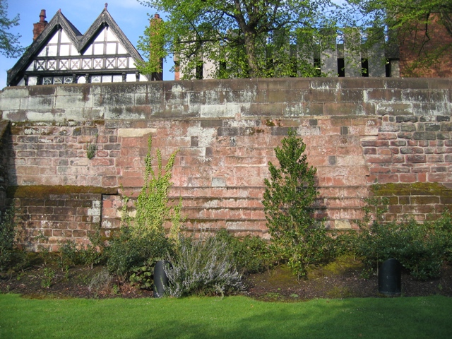
English: Civil war siege damage to the city walls The lighter coloured section of the city walls indicates where the walls were breached during the English civil war. Park Street runs alongside the other side of the wall in front of the black and white Victorian building on the left, and the 1960s concrete car park on the right. |
| Date | |
| Source | From geograph.org.uk |
| Author | John S Turner |
| Attribution (required by the license) | John S Turner / Civil war siege damage to the city walls / |
| Camera location | | View this and other nearby images on: OpenStreetMap |
|---|
_heading:247.00&language=en)
| Object location | | View this and other nearby images on: OpenStreetMap |
|---|
_heading:247.00&language=en)
Licensing

|
This image was taken from the Geograph project collection. See this photograph's page on the Geograph website for the photographer's contact details. The copyright on this image is owned by John S Turner and is licensed for reuse under the Creative Commons Attribution-ShareAlike 2.0 license.
|
This file is licensed under the Creative Commons Attribution-Share Alike 2.0 Generic license.
Attribution: John S Turner
- You are free:
- to share – to copy, distribute and transmit the work
- to remix – to adapt the work
- Under the following conditions:
- attribution – You must give appropriate credit, provide a link to the license, and indicate if changes were made. You may do so in any reasonable manner, but not in any way that suggests the licensor endorses you or your use.
- share alike – If you remix, transform, or build upon the material, you must distribute your contributions under the same or compatible license as the original.
File history
Click on a date/time to view the file as it appeared at that time.
| Date/Time | Thumbnail | Dimensions | User | Comment | |
|---|---|---|---|---|---|
| current | 15:15, 20 February 2011 | | 640 × 480 (235 KB) | GeographBot | == {{int:filedesc}} == {{Information |description={{en|1=Civil war siege damage to the city walls The lighter coloured section of the city walls indicates where the walls were breached during the English civil war. Park Street runs alongside the other si |
File usage
The following pages on the English Wikipedia use this file (pages on other projects are not listed):
Global file usage
The following other wikis use this file:
- Usage on da.wikipedia.org