
File:Confluence of the rivers Southern Bug and Dnieper.jpg

Size of this preview: 799 × 310 pixels. Other resolutions: 320 × 124 pixels | 640 × 248 pixels | 1,024 × 397 pixels | 1,280 × 497 pixels | 2,560 × 993 pixels | 7,586 × 2,944 pixels.
Original file (7,586 × 2,944 pixels, file size: 2.13 MB, MIME type: image/jpeg)
| This is a file from the Wikimedia Commons. Information from its description page there is shown below. Commons is a freely licensed media file repository. You can help. |
Summary
| Description |
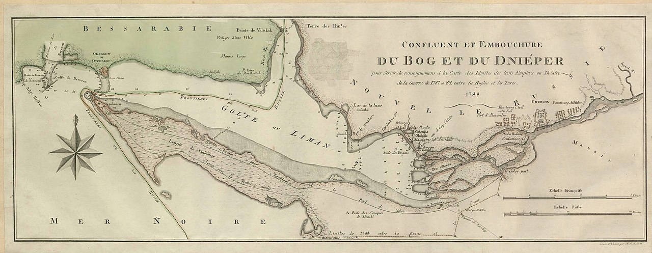
English: Map showing confluence of the rivers Southern Bug and Dnieper and the Dnieper-(Southern) Bug estuary. The map was created during the Russo-Turkish War of 1787–1792.
Svenska: Karta över Dnipro-Buh estuariet. |
||||||||||||||||||||||||||
| Date | |||||||||||||||||||||||||||
| Source |
Utländska kartor, Ryssland, hydrografiska kartor, SE/KrA/0403/34/A/022b, bildid: K0022144_00001 https://sok.riksarkivet.se/arkiv/pxt3CiEqjagtKneJgfRFN3 |
||||||||||||||||||||||||||
| Creator |
Unknown author |
||||||||||||||||||||||||||
| Permission (Reusing this file) |
|
||||||||||||||||||||||||||
| Georeferencing | If inappropriate please set warp_status = skip to hide. | ||||||||||||||||||||||||||


Licensing
|
This work is in the public domain in its country of origin and other countries and areas where the copyright term is the author's life plus 70 years or fewer. | |
| This file has been identified as being free of known restrictions under copyright law, including all related and neighboring rights. | |
File history
Click on a date/time to view the file as it appeared at that time.
| Date/Time | Thumbnail | Dimensions | User | Comment | |
|---|---|---|---|---|---|
| current | 09:46, 13 December 2022 | 7,586 × 2,944 (2.13 MB) | DivadH | Uploaded a work by Unknown from https://sok.riksarkivet.se/arkiv/pxt3CiEqjagtKneJgfRFN3 with UploadWizard |
File usage
The following 2 pages use this file:
Global file usage
The following other wikis use this file:
- Usage on hr.wikipedia.org
- Usage on sv.wikipedia.org