
File:Dunster Butter Cross - geograph.org.uk - 1702292.jpg
No higher resolution available.
Dunster_Butter_Cross_-_geograph.org.uk_-_1702292.jpg (640 × 427 pixels, file size: 106 KB, MIME type: image/jpeg)
| This is a file from the Wikimedia Commons. Information from its description page there is shown below. Commons is a freely licensed media file repository. You can help. |
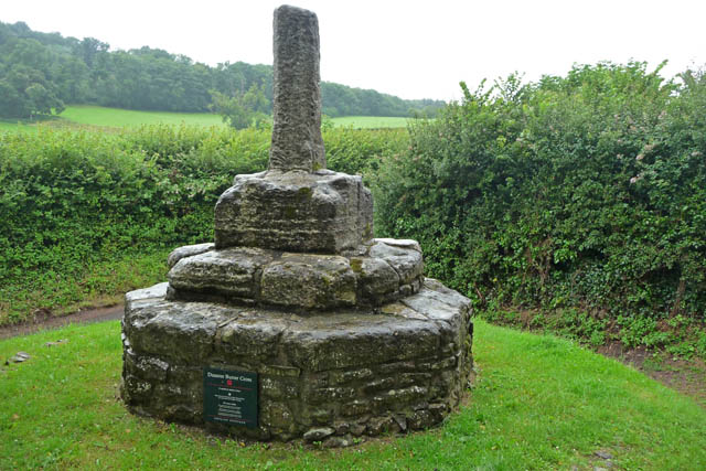
This is a photo of listed building number 1345602. |
Summary
| Description |
English: Dunster Butter Cross, Somerset. The stump of a late 14th- or early 15th-century cross, beside a lane some way from the centre of the village. Some sources indicate that this was relocated, hence its out of the way site. |
| Date | |
| Source | From geograph.org.uk |
| Author | Phil Champion |
| Attribution (required by the license) | Phil Champion / Dunster Butter Cross / |
| Camera location | | View this and other nearby images on: OpenStreetMap |
|---|
_heading:67.00&language=en)
| Object location | | View this and other nearby images on: OpenStreetMap |
|---|
_heading:67.00&language=en)
Licensing

|
This image was taken from the Geograph project collection. See this photograph's page on the Geograph website for the photographer's contact details. The copyright on this image is owned by Phil Champion and is licensed for reuse under the Creative Commons Attribution-ShareAlike 2.0 license.
|
This file is licensed under the Creative Commons Attribution-Share Alike 2.0 Generic license.
Attribution: Phil Champion
- You are free:
- to share – to copy, distribute and transmit the work
- to remix – to adapt the work
- Under the following conditions:
- attribution – You must give appropriate credit, provide a link to the license, and indicate if changes were made. You may do so in any reasonable manner, but not in any way that suggests the licensor endorses you or your use.
- share alike – If you remix, transform, or build upon the material, you must distribute your contributions under the same or compatible license as the original.
File history
Click on a date/time to view the file as it appeared at that time.
| Date/Time | Thumbnail | Dimensions | User | Comment | |
|---|---|---|---|---|---|
| current | 04:51, 5 March 2011 | | 640 × 427 (106 KB) | GeographBot | == {{int:filedesc}} == {{Information |description={{en|1=Dunster Butter Cross The stump of a late 14th / early 15th century wayside cross, located beside a lane some way from the centre of the village. Some sources indicate that this was relocated, hence |
File usage
The following pages on the English Wikipedia use this file (pages on other projects are not listed):
Global file usage
The following other wikis use this file:
- Usage on bn.wikipedia.org
- Usage on es.wikipedia.org
- Usage on www.wikidata.org
- Usage on zh.wikipedia.org