
File:Ellington crater Berkel crater EW0252814064I.3band.plusmono.png
Original file (1,422 × 1,423 pixels, file size: 2.29 MB, MIME type: image/png)
| This is a file from the Wikimedia Commons. Information from its description page there is shown below. Commons is a freely licensed media file repository. You can help. |
Summary
| Description |
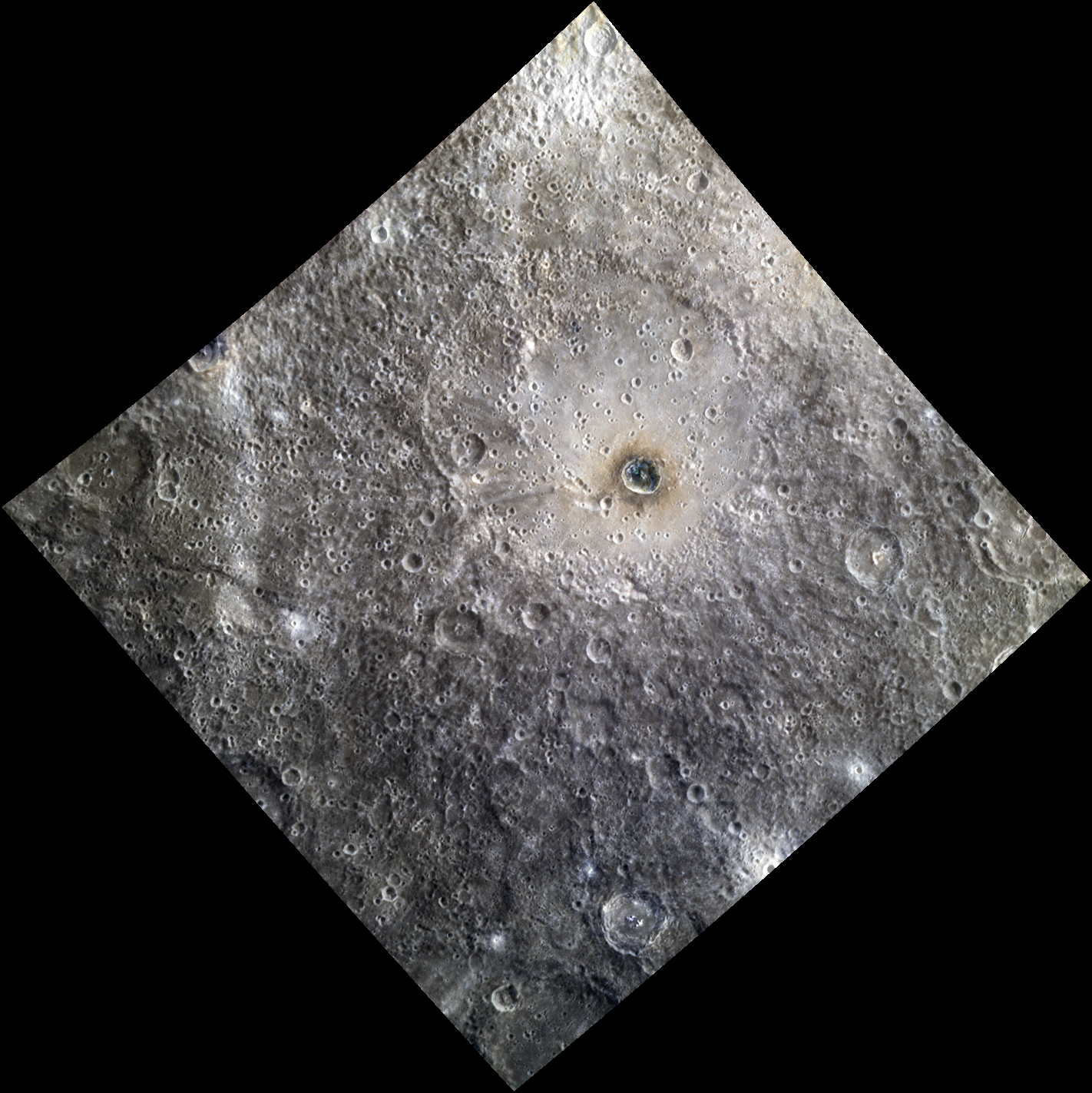
English: Date acquired: August 07, 2012 Image Mission Elapsed Time (MET): 252814064, 252814056, 252814060 Of Interest: Ellington basin, named in 2012 for American jazz legend Duke Ellington (1899-1974), is a peak ring basin covered in secondary craters. The prominent crater Berkel lies inside of the basin. Berkel's ejecta and floor exhibit differences in reflectance and color, indicating a heterogeneous local stratigraphy. This image was created by merging a color image with a monochrome image, in order to emphasize both the topography and the color of the area. The color portion of this image was acquired as part of MDIS's high-resolution 3-color imaging campaign. The 3-color campaign is a major mapping activity in MESSENGER's extended mission. It complements the 8-color base map (at an average resolution of 1 km/pixel) acquired during MESSENGER's primary mission by imaging Mercury's surface in a subset of the color filters at the highest resolution possible. The three narrow-band color filters are centered at wavelengths of 430 nm, 750 nm, and 1000 nm, and image resolutions generally range from 100 to 400 meters/pixel in the northern hemisphere. The monochrome portion of this image is part of MDIS's high-resolution surface morphology base map. The surface morphology base map covers more than 90% of Mercury's surface with an average resolution of 250 meters/pixel (0.16 miles/pixel or 820 feet/pixel). Images acquired for the surface morphology base map typically have off-vertical Sun angles (i.e., high incidence angles) and visible shadows so as to reveal clearly the topographic form of geologic features. |
| Date | |
| Source | IT DON'T MEAN A THING |
| Author | NASA/Johns Hopkins University Applied Physics Laboratory/Carnegie Institution of Washington |
Licensing
| This file is in the public domain in the United States because it was solely created by NASA. NASA copyright policy states that "NASA material is not protected by copyright unless noted". (See Template:PD-USGov, NASA copyright policy page or JPL Image Use Policy.) | ||
 |
Warnings:
|
File history
Click on a date/time to view the file as it appeared at that time.
| Date/Time | Thumbnail | Dimensions | User | Comment | |
|---|---|---|---|---|---|
| current | 19:47, 15 August 2020 | | 1,422 × 1,423 (2.29 MB) | Jstuby | Uploaded a work by NASA/Johns Hopkins University Applied Physics Laboratory/Carnegie Institution of Washington from [https://messenger.jhuapl.edu/Explore/Science-Images-Database/gallery-image-1067.html IT DON'T MEAN A THING] with UploadWizard |
File usage
Global file usage
The following other wikis use this file:
- Usage on ca.wikipedia.org
- Usage on it.wikipedia.org
- Usage on www.wikidata.org