
File:Elsa Florida Satellite Loop.gif
Size of this preview: 600 × 600 pixels. Other resolutions: 240 × 240 pixels | 480 × 480 pixels | 1,000 × 1,000 pixels.
Original file (1,000 × 1,000 pixels, file size: 29.65 MB, MIME type: image/gif, looped, 50 frames, 4.9 s)
| This is a file from the Wikimedia Commons. Information from its description page there is shown below. Commons is a freely licensed media file repository. You can help. |
Summary
| Description |
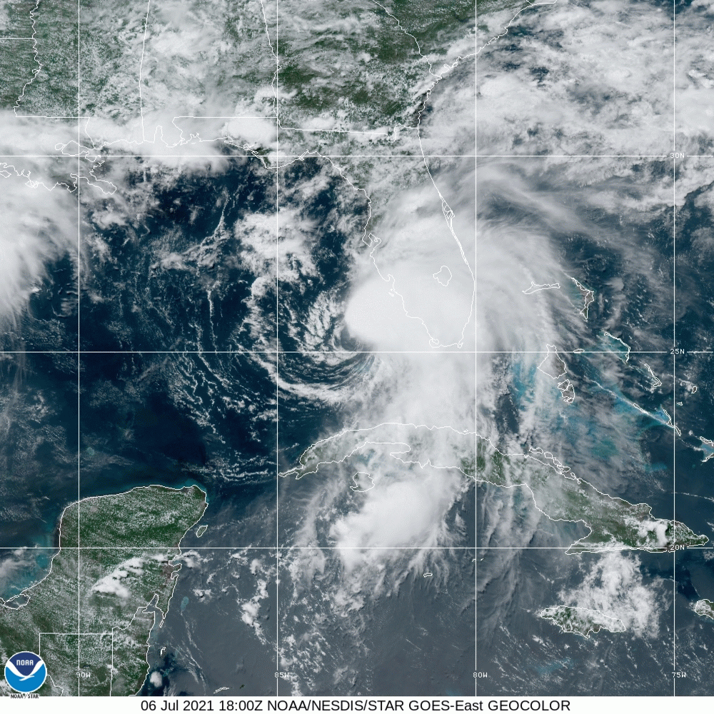
English: Satellite loop of Hurricane Elsa between 18:00 UTC on Tuesday July 6th, 2021 to 2:10 UTC on Wednesday July 7th, 2021 (2:00 PM to 10:10 PM) (Local Time) approaching landfall in Florida. |
| Date | |
| Source | https://www.star.nesdis.noaa.gov/GOES/ |
| Author | NOAA |
Licensing
This image is in the public domain because it contains materials that originally came from the U.S. National Oceanic and Atmospheric Administration, taken or made as part of an employee's official duties.
|
File history
Click on a date/time to view the file as it appeared at that time.
| Date/Time | Thumbnail | Dimensions | User | Comment | |
|---|---|---|---|---|---|
| current | 03:06, 7 July 2021 | | 1,000 × 1,000 (29.65 MB) | TheWxResearcher | Uploaded a work by NOAA from https://www.star.nesdis.noaa.gov/GOES/ with UploadWizard |
File usage
The following pages on the English Wikipedia use this file (pages on other projects are not listed):
Global file usage
The following other wikis use this file:
- Usage on es.wikipedia.org
- Usage on fr.wikipedia.org