
File:Enewetak Atoll - 2002-02-07 - Landsat 7 ETM+ SLC - b3218 - 15m.png

Size of this preview: 589 × 599 pixels. Other resolutions: 236 × 240 pixels | 472 × 480 pixels | 755 × 768 pixels | 1,007 × 1,024 pixels | 2,014 × 2,048 pixels | 2,808 × 2,856 pixels.
Original file (2,808 × 2,856 pixels, file size: 16.37 MB, MIME type: image/png)
| This is a file from the Wikimedia Commons. Information from its description page there is shown below. Commons is a freely licensed media file repository. You can help. |
Summary
| Description |
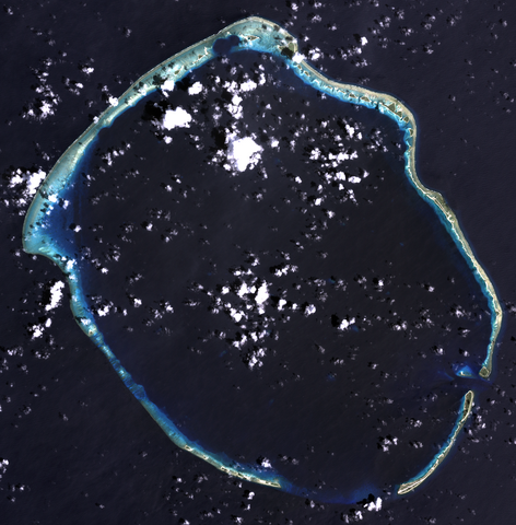
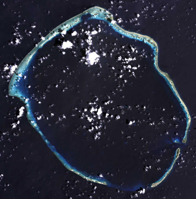
English: Composite "true color" multispectral satellite image of Enewetak Atoll, Marshall Islands.
NASA Landsat 7 ETM+ bands used were 3 (red), 2 (green), 1 (blue), and the image was pan-sharpened to 15m resolution. Imagery courtesy of NASA/USGS. |
| Date | |
| Source | NASA Landsat satellite image GeoTIFF archive, http://glovis.usgs.gov |
| Author | NASA |
| Camera location | | View this and other nearby images on: OpenStreetMap |
|---|
Licensing
| This file is in the public domain in the United States because it was solely created by NASA. NASA copyright policy states that "NASA material is not protected by copyright unless noted". (See Template:PD-USGov, NASA copyright policy page or JPL Image Use Policy.) | ||
 |
Warnings:
|
File history
Click on a date/time to view the file as it appeared at that time.
| Date/Time | Thumbnail | Dimensions | User | Comment | |
|---|---|---|---|---|---|
| current | 05:06, 24 September 2012 | | 2,808 × 2,856 (16.37 MB) | Разрывные | User created page with UploadWizard |
File usage
The following pages on the English Wikipedia use this file (pages on other projects are not listed):
Global file usage
The following other wikis use this file:
- Usage on pl.wikipedia.org