
File:Footpaths on Norton Hillfort - geograph.org.uk - 1407564.jpg
No higher resolution available.
Footpaths_on_Norton_Hillfort_-_geograph.org.uk_-_1407564.jpg (640 × 480 pixels, file size: 133 KB, MIME type: image/jpeg)
| This is a file from the Wikimedia Commons. Information from its description page there is shown below. Commons is a freely licensed media file repository. You can help. |
Summary
| Description |
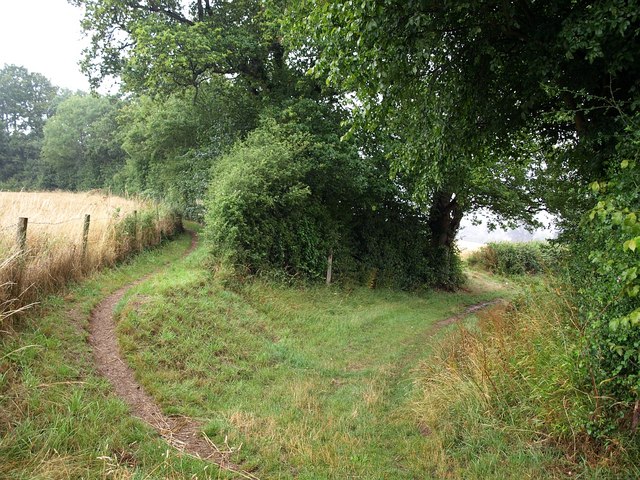
English: Footpaths on Norton Hillfort. Footpath T 18/1, which has followed the circular earthwork for about a third of its circumference, branches off to the right here to follow the field boundary glimpsed through the gap towards Langford. A trail continues around the perimeter of the hillfort, shown as Norton Camp on the maps, and which also appears in 50048. Stone tools show that the site has been in use for a quarter of a million years, initially by an early form of human. The bronze and Iron Age earthworks were used by the Romans, but after 100 AD the settlement was abandoned. In the Middle Ages it was used as a deer park. |
| Date | |
| Source | From geograph.org.uk |
| Author | Derek Harper |
| Attribution (required by the license) | Derek Harper / Footpaths on Norton Hillfort / |
| Camera location | | View this and other nearby images on: OpenStreetMap |
|---|
_heading:0.00&language=en)
| Object location | | View this and other nearby images on: OpenStreetMap |
|---|
_heading:0.00&language=en)
Licensing

|
This image was taken from the Geograph project collection. See this photograph's page on the Geograph website for the photographer's contact details. The copyright on this image is owned by Derek Harper and is licensed for reuse under the Creative Commons Attribution-ShareAlike 2.0 license.
|
This file is licensed under the Creative Commons Attribution-Share Alike 2.0 Generic license.
Attribution: Derek Harper
- You are free:
- to share – to copy, distribute and transmit the work
- to remix – to adapt the work
- Under the following conditions:
- attribution – You must give appropriate credit, provide a link to the license, and indicate if changes were made. You may do so in any reasonable manner, but not in any way that suggests the licensor endorses you or your use.
- share alike – If you remix, transform, or build upon the material, you must distribute your contributions under the same or compatible license as the original.
File history
Click on a date/time to view the file as it appeared at that time.
| Date/Time | Thumbnail | Dimensions | User | Comment | |
|---|---|---|---|---|---|
| current | 12:24, 1 March 2011 | | 640 × 480 (133 KB) | GeographBot | == {{int:filedesc}} == {{Information |description={{en|1=Footpaths on Norton Hillfort Footpath T 18/1, which has followed the circular earthwork for about a third of its circumference, branches off to the right here to follow the field boundary glimpsed t |
File usage
The following pages on the English Wikipedia use this file (pages on other projects are not listed):