
File:Fort Bainbridge and Decatur.jpg

Size of this preview: 800 × 427 pixels. Other resolutions: 320 × 171 pixels | 640 × 341 pixels | 1,380 × 736 pixels.
Original file (1,380 × 736 pixels, file size: 166 KB, MIME type: image/jpeg)
| This is a file from the Wikimedia Commons. Information from its description page there is shown below. Commons is a freely licensed media file repository. You can help. |
Summary
| Description |
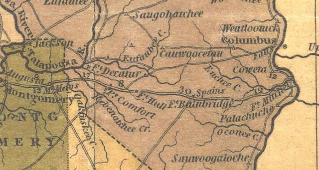
English: 1830 map showing the location of Forts Decatur and Bainbridge and their location on stage routes. |
| Date | |
| Source | https://digital.archives.alabama.gov/digital/collection/maps/id/66 |
| Author | Henry Schenck Tanner |
Licensing
|
This work is in the public domain in its country of origin and other countries and areas where the copyright term is the author's life plus 70 years or fewer. This work is in the public domain in the United States because it was published (or registered with the U.S. Copyright Office) before January 1, 1929. | |
| This file has been identified as being free of known restrictions under copyright law, including all related and neighboring rights. | |
File history
Click on a date/time to view the file as it appeared at that time.
| Date/Time | Thumbnail | Dimensions | User | Comment | |
|---|---|---|---|---|---|
| current | 03:21, 11 October 2021 | | 1,380 × 736 (166 KB) | Dofftoubab | Uploaded a work by Henry Schenck Tanner from https://digital.archives.alabama.gov/digital/collection/maps/id/66 with UploadWizard |
File usage
The following pages on the English Wikipedia use this file (pages on other projects are not listed):