
File:Georgia Mexico Locator.png

Size of this preview: 800 × 408 pixels. Other resolutions: 320 × 163 pixels | 640 × 326 pixels | 1,272 × 648 pixels.
Original file (1,272 × 648 pixels, file size: 41 KB, MIME type: image/png)
| This is a file from the Wikimedia Commons. Information from its description page there is shown below. Commons is a freely licensed media file repository. You can help. |
Summary
| Description |
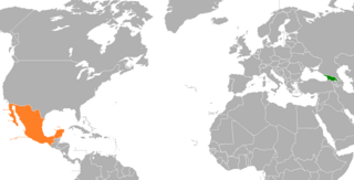
English: Georgia-Mexico locator map. I made this map out of a licence free blank map of the world. |
| Date | 1 February 2009 (original upload date) |
| Source | Transferred from en.wikipedia to Commons. |
| Author | The original uploader was Groubani at English Wikipedia. |
Licensing

|
Permission is granted to copy, distribute and/or modify this document under the terms of the GNU Free Documentation License, Version 1.2 or any later version published by the Free Software Foundation; with no Invariant Sections, no Front-Cover Texts, and no Back-Cover Texts. A copy of the license is included in the section entitled GNU Free Documentation License. |
| This file is licensed under the Creative Commons Attribution-Share Alike 3.0 Unported license. | ||
| ||
| This licensing tag was added to this file as part of the GFDL licensing update. |
Original upload log
The original description page was here. All following user names refer to en.wikipedia.
- 2009-02-01 14:24 Groubani 1427×628× (56546 bytes) I made this map out of a licence free blank map of the world.
File history
Click on a date/time to view the file as it appeared at that time.
| Date/Time | Thumbnail | Dimensions | User | Comment | |
|---|---|---|---|---|---|
| current | 01:57, 14 July 2017 | | 1,272 × 648 (41 KB) | Fobos92 | . |
| 00:30, 16 May 2015 |  | 1,425 × 625 (64 KB) | Aquintero82 | Updated map | |
| 17:48, 3 September 2012 |  | 1,427 × 628 (55 KB) | MGA73bot2 | {{BotMoveToCommons|en.wikipedia|year={{subst:CURRENTYEAR}}|month={{subst:CURRENTMONTHNAME}}|day={{subst:CURRENTDAY}}}} {{Information |Description={{en|I made this map out of a licence free blank map of the world.}} |Source=Transferred from [http://en... |
File usage
The following pages on the English Wikipedia use this file (pages on other projects are not listed):
Global file usage
The following other wikis use this file:
- Usage on az.wikipedia.org
- Usage on es.wikipedia.org
- Usage on he.wikipedia.org
- Usage on hy.wikipedia.org
- Usage on ka.wikipedia.org
- Usage on ru.wikipedia.org
- Usage on www.wikidata.org