
File:Gloucester Women's Club, U.S. Route 17 & State Route 14, Gloucester (Gloucester County, Virginia).jpg
Size of this preview: 764 × 600 pixels. Other resolutions: 306 × 240 pixels | 612 × 480 pixels | 949 × 745 pixels.
Original file (949 × 745 pixels, file size: 278 KB, MIME type: image/jpeg)
| This is a file from the Wikimedia Commons. Information from its description page there is shown below. Commons is a freely licensed media file repository. You can help. |
|
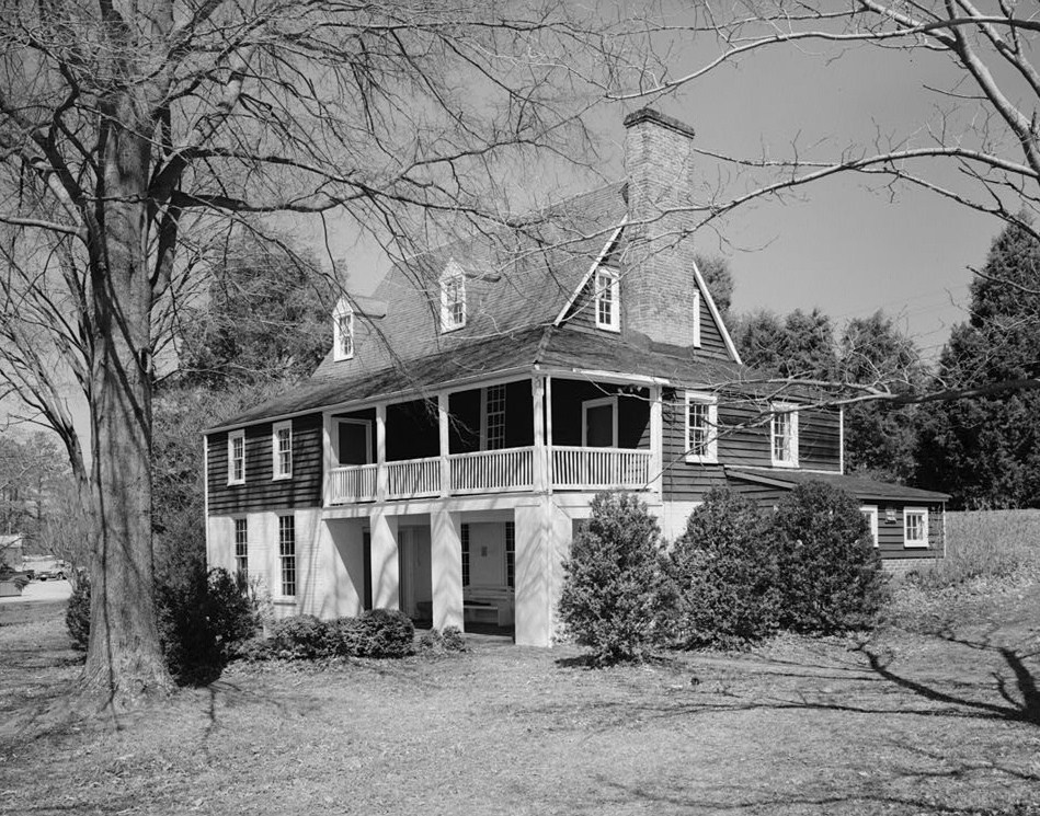
This is an image of a place or building that is listed on the National Register of Historic Places in the United States of America. Its reference number is 74002117. |
| Description |
English: Gloucester Women's Club, U.S. Route 17 & State Route 14, Gloucester (Gloucester County, Virginia)
cropped
|
|||||||||||||||||||||||
| Date | ||||||||||||||||||||||||
| Source | http://memory.loc.gov/pnp/habshaer/va/va0400/va0465/photos/161837pv.jpg | |||||||||||||||||||||||
| Author |
|
|||||||||||||||||||||||

.jpg)
.jpg)
| Object location | | View this and other nearby images on: OpenStreetMap |
|---|
.jpg¶ms=037.412222_N_-076.519722_E_globe:Earth_class:object_region:US_type:landmark_scale:1500_&language=en)
File history
Click on a date/time to view the file as it appeared at that time.
| Date/Time | Thumbnail | Dimensions | User | Comment | |
|---|---|---|---|---|---|
| current | 21:07, 14 December 2010 | | 949 × 745 (278 KB) | KudzuVine | {{Information |Description={{en|1=Gloucester Women's Club, U.S. Route 17 & State Route 14, Gloucester (Gloucester County, Virginia) cropped {{PD-USGov-Interior-HABS|VA,37-GLO,3-4}} }} |Source=http://memory.loc.gov/pnp/habshaer/va/va0400/va0465/photos/1618 |
File usage
The following pages on the English Wikipedia use this file (pages on other projects are not listed):
Global file usage
The following other wikis use this file:
- Usage on www.wikidata.org
.jpg)