
File:Ground Plan of the Royal Fort, Bristol, 1644.jpg

Original file (1,428 × 1,063 pixels, file size: 1 MB, MIME type: image/jpeg)
| This is a file from the Wikimedia Commons. Information from its description page there is shown below. Commons is a freely licensed media file repository. You can help. |
Summary
| Description |
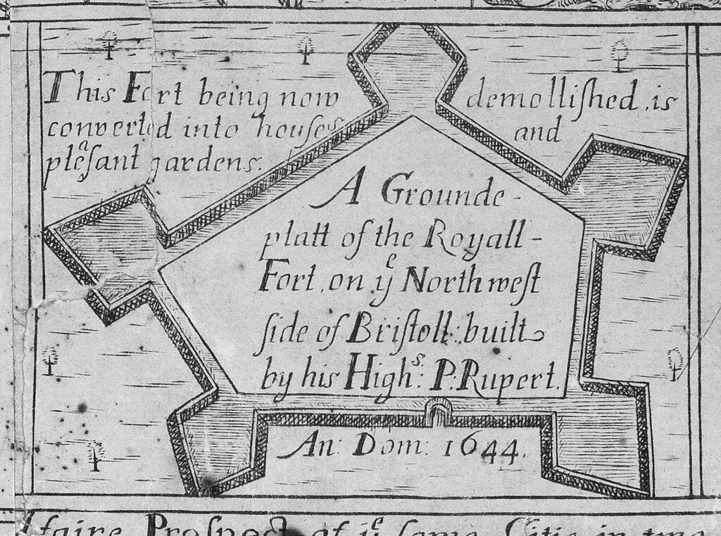
English: A 1673 depiction of the ground plan of the Royal Fort, Bristol. As noted, by the time the map was drawn in 1673, the Fort had demolished and converted into houses and gardens. |
| Date | |
| Source | Detail from the 1728 updated edition of James Millerd's map An Exact Delineation of the Famous Citty of Bristoll and Suburbs, first published in 1673. Digitisation undertaken by the Bristol Record Society of an engraving owned by the Society of Merchant Venturers, Bristol. |
| Author | James Millerd and unknown later editors. |
| Permission (Reusing this file) |
The Society of Merchant Venturers and the Bristol Record Society make the images freely available on a creative commons license (2020). If reproducing the images in a publication, in whole or part, please acknowledge the Society of Merchant Venturers. |
| Camera location | | View this and other nearby images on: OpenStreetMap |
|---|
Licensing
|
This is a faithful photographic reproduction of a two-dimensional, public domain work of art. The work of art itself is in the public domain for the following reason:
The official position taken by the Wikimedia Foundation is that "faithful reproductions of two-dimensional public domain works of art are public domain".
This photographic reproduction is therefore also considered to be in the public domain in the United States. In other jurisdictions, re-use of this content may be restricted; see Reuse of PD-Art photographs for details. | ||||
File history
Click on a date/time to view the file as it appeared at that time.
| Date/Time | Thumbnail | Dimensions | User | Comment | |
|---|---|---|---|---|---|
| current | 14:27, 17 June 2023 | | 1,428 × 1,063 (1 MB) | Evan T Jones | Uploaded a work by James Millerd from Detail from the 1728 updated edition of James Millerd's map 'An Exact Delineation of the Famous Citty of Bristoll and Suburbs', first published in 1673. with UploadWizard |