
File:Gulf of Piran sat borders.png
Size of this preview: 800 × 493 pixels. Other resolutions: 320 × 197 pixels | 640 × 394 pixels | 990 × 610 pixels.
Original file (990 × 610 pixels, file size: 875 KB, MIME type: image/png)
| This is a file from the Wikimedia Commons. Information from its description page there is shown below. Commons is a freely licensed media file repository. You can help. |
| Description |
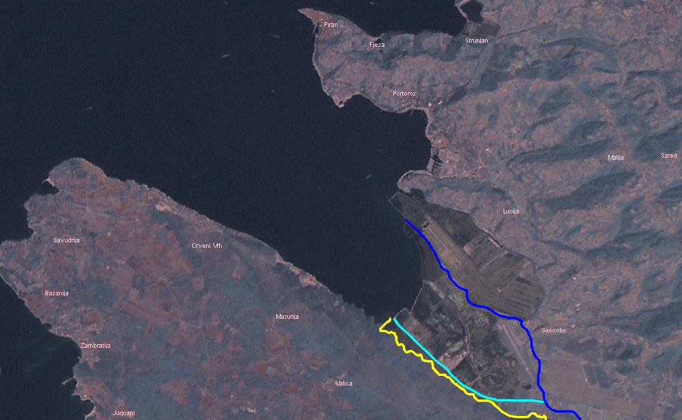
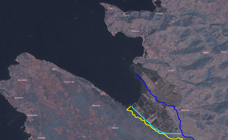
English: Satellite photo of Gulf of Piran. |
| Date | 17 June 2009 (original upload date) |
| Source | Transferred from en.wikipedia to Commons. |
| Author | The original uploader was No such user at English Wikipedia. |
Licensing
Original flow of Dragonja
Artificial canal of St. Odorick
Slovenian claimed border
| This image is in the public domain because it is a screenshot from NASA’s globe software World Wind using a public domain layer, such as Blue Marble, MODIS, Landsat, SRTM, USGS or GLOBE.
|
 |
Original upload log
The original description page was here. All following user names refer to en.wikipedia.
- 2009-06-17 13:12 No such user 990×610× (896039 bytes) Satellite photo of [[Gulf of Piran]]. {{PD-WorldWind}}
File history
Click on a date/time to view the file as it appeared at that time.
| Date/Time | Thumbnail | Dimensions | User | Comment | |
|---|---|---|---|---|---|
| current | 16:48, 4 April 2010 | | 990 × 610 (875 KB) | Urdangaray | {{Information |Description={{en|Satellite photo of en:Gulf of Piran.}} |Source=Transferred from [http://en.wikipedia.org en.wikipedia] |Date={{Date|2009|06|17}} (original upload date) |Author=Original uploader was [[:en:User:No such user|No such use |
File usage
The following pages on the English Wikipedia use this file (pages on other projects are not listed):
Global file usage
The following other wikis use this file:
- Usage on ar.wikipedia.org
- Usage on de.wikipedia.org
- Usage on es.wikipedia.org
- Usage on hr.wikipedia.org
- Usage on mk.wikipedia.org
- Usage on sv.wikipedia.org
- Usage on uk.wikipedia.org
- Usage on www.wikidata.org