
File:Hont county administrative map.jpg
Size of this preview: 467 × 599 pixels. Other resolutions: 187 × 240 pixels | 374 × 480 pixels | 598 × 768 pixels | 798 × 1,024 pixels | 1,356 × 1,740 pixels.
Original file (1,356 × 1,740 pixels, file size: 534 KB, MIME type: image/jpeg)
| This is a file from the Wikimedia Commons. Information from its description page there is shown below. Commons is a freely licensed media file repository. You can help. |
Summary
| Description |
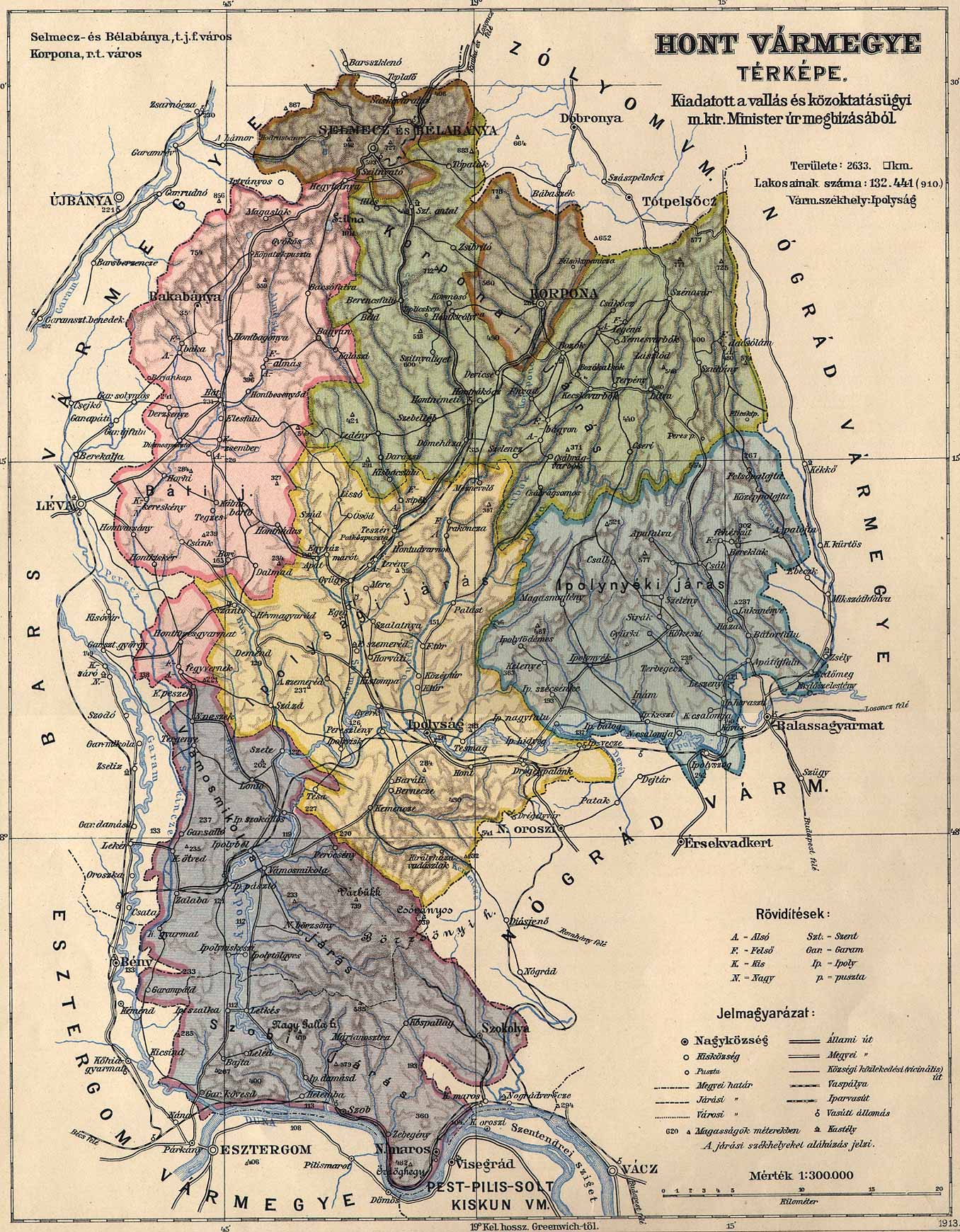
English: Administrative map of the county of Hont in the Kingdom of Hungary from 1913. Borders of Vámosmikola district, organized in 1907, were added in the last minute with limited accuracy. Magyar: Hont vármegye közigazgatási térképe 1913-ból. Az 1907-ben szervezett Vámosmikolai járás határa utólag és nem teljesen pontosan került ábrázolásra. |
| Date | |
| Source | http://lazarus.elte.hu/hun/maps/1910/vmlista.htm |
| Author | Unknown author |
This file was uploaded with Commonist.
Licensing
|
This work is in the public domain in its country of origin and other countries and areas where the copyright term is the author's life plus 70 years or fewer. | |
| This file has been identified as being free of known restrictions under copyright law, including all related and neighboring rights. | |
File history
Click on a date/time to view the file as it appeared at that time.
| Date/Time | Thumbnail | Dimensions | User | Comment | |
|---|---|---|---|---|---|
| current | 13:55, 5 September 2014 | | 1,356 × 1,740 (534 KB) | Szilas |
File usage
The following pages on the English Wikipedia use this file (pages on other projects are not listed):
Global file usage
The following other wikis use this file:
- Usage on de.wikipedia.org
- Usage on hu.wikipedia.org