
File:Isla de Lobos - Gorriti UY.PNG

Size of this preview: 800 × 400 pixels. Other resolutions: 320 × 160 pixels | 640 × 320 pixels | 1,440 × 720 pixels.
Original file (1,440 × 720 pixels, file size: 48 KB, MIME type: image/png)
| This is a file from the Wikimedia Commons. Information from its description page there is shown below. Commons is a freely licensed media file repository. You can help. |
Summary
| Description |
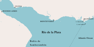
English: Location of Lobos and Gorriti Islands, Uruguay
Español: Ubicación de las islas de Lobos y Gorriti, Uruguay |
| Date | |
| Source | File:Rio_de_la_Plata_1806.gif |
| Author | Leandro Palacios; modified by Izmir2 |
| Object location | | View this and other nearby images on: OpenStreetMap |
|---|
Licensing
| I, the copyright holder of this work, release this work into the public domain. This applies worldwide. In some countries this may not be legally possible; if so: I grant anyone the right to use this work for any purpose, without any conditions, unless such conditions are required by law. |
File history
Click on a date/time to view the file as it appeared at that time.
| Date/Time | Thumbnail | Dimensions | User | Comment | |
|---|---|---|---|---|---|
| current | 04:31, 13 November 2010 | | 1,440 × 720 (48 KB) | Izmir2 | {{Information |Description={{en|1=Location of Lobos and Gorriti Islands, Uruguay}} {{es|1=Ubicación de las islas de Lobos y Gorriti, Uruguay}} |Source=http://commons.wikimedia.org/wiki/File:Rio_de_la_Plata_1806.gif |Author=Leandro Palacios; modified by [ |
File usage
The following pages on the English Wikipedia use this file (pages on other projects are not listed):
Global file usage
The following other wikis use this file:
- Usage on az.wikipedia.org
- Usage on ca.wikipedia.org
- Usage on ceb.wikipedia.org
- Usage on de.wikipedia.org
- Usage on es.wikipedia.org
- Usage on fr.wikipedia.org
- Usage on nl.wikipedia.org
- Usage on ru.wikipedia.org
- Usage on www.wikidata.org