
File:JapaneseAddressPlateWithEnglishExplanation.JPG
Size of this preview: 450 × 600 pixels. Other resolutions: 180 × 240 pixels | 360 × 480 pixels | 576 × 768 pixels | 1,200 × 1,600 pixels.
Original file (1,200 × 1,600 pixels, file size: 301 KB, MIME type: image/jpeg)
| This is a file from the Wikimedia Commons. Information from its description page there is shown below. Commons is a freely licensed media file repository. You can help. |
Summary
| Description |
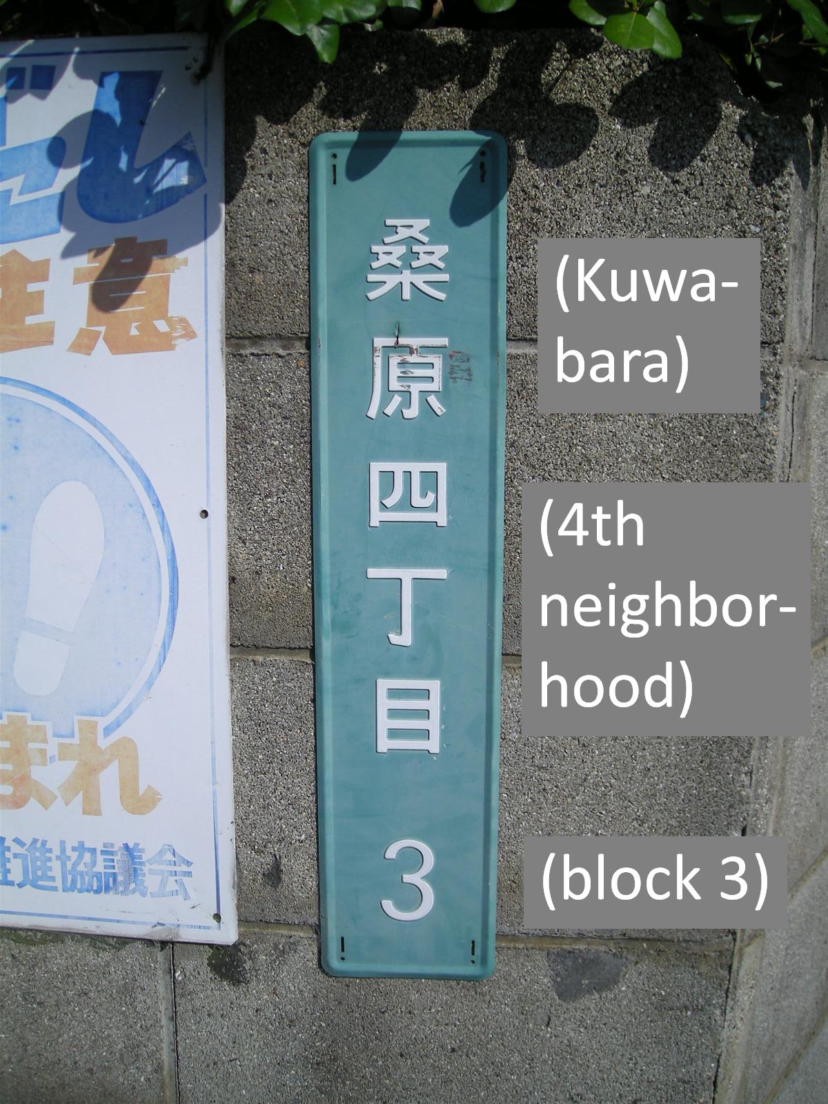
English: Japanese address system nameplate in the Kuwabara 4 cho me section of Matsuyama, Ehime, Japan, with English description of the kanji added digitally. 愛媛県松山市桑原4丁目3 |
| Date | 5/12/2008 |
| Source | Own work |
| Author | Snolygoster |
| Camera location | | View this and other nearby images on: OpenStreetMap |
|---|
Licensing
| I, the copyright holder of this work, release this work into the public domain. This applies worldwide. In some countries this may not be legally possible; if so: I grant anyone the right to use this work for any purpose, without any conditions, unless such conditions are required by law. |
File history
Click on a date/time to view the file as it appeared at that time.
| Date/Time | Thumbnail | Dimensions | User | Comment | |
|---|---|---|---|---|---|
| current | 00:36, 2 August 2008 | | 1,200 × 1,600 (301 KB) | Snolygoster | {{Information |Description={{en|1=Japanese address system nameplate in the Kuwabara 4 cho me section of Matsuyama, Ehime, Japan, with English description of the kanji added digitally. 愛媛県松山市桑原4丁目}} |Source=Own work by uploader |Autho |
File usage
The following pages on the English Wikipedia use this file (pages on other projects are not listed):
Global file usage
The following other wikis use this file:
- Usage on it.wikipedia.org
- Usage on pl.wikipedia.org
- Usage on vi.wikipedia.org