
File:John Norden's Map of Westminster Large version.jpeg
Size of this preview: 800 × 556 pixels. Other resolutions: 320 × 222 pixels | 640 × 445 pixels | 1,024 × 712 pixels | 1,280 × 890 pixels | 2,560 × 1,779 pixels | 3,050 × 2,120 pixels.
Original file (3,050 × 2,120 pixels, file size: 2.16 MB, MIME type: image/jpeg)
| This is a file from the Wikimedia Commons. Information from its description page there is shown below. Commons is a freely licensed media file repository. You can help. |
Summary
| Description |
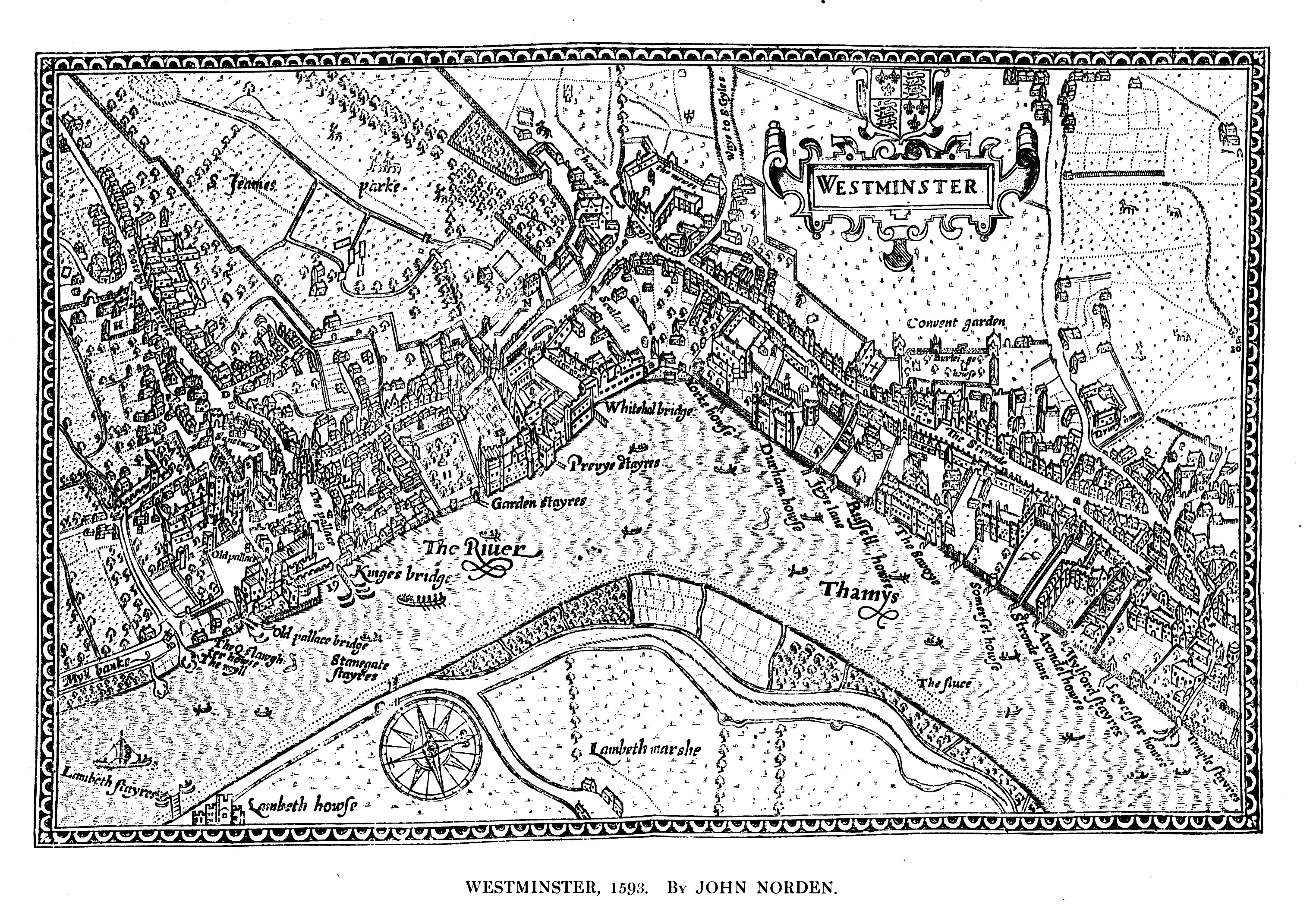
English: John Norden's Map of Westminster, 1593, engraved by Pieter Van den Keere. Original size 9.5 x 6.75 inches, published in Norden's "Middlesex", dated 1593. Norden was born c. 1548, and was made Surveyor of His Majesty's Woods in 1609. |
| Date | |
| Source | Maps of Old London, London, Adam and Charles Black, 1908. Scanned & corrected Mike Calder. |
| Author | Mike Calder, image of John Norden's Map of Westminster, 1593 |
| Other versions |
Derivative works of this file: |
Licensing
| I, the copyright holder of this work, release this work into the public domain. This applies worldwide. In some countries this may not be legally possible; if so: I grant anyone the right to use this work for any purpose, without any conditions, unless such conditions are required by law. |
File history
Click on a date/time to view the file as it appeared at that time.
| Date/Time | Thumbnail | Dimensions | User | Comment | |
|---|---|---|---|---|---|
| current | 14:58, 14 August 2009 | | 3,050 × 2,120 (2.16 MB) | MikeCalder | {{Information |Description={{en|1=John Norden's Map of Westminster, 1593, engraved by Pieter Van den Keere. Original size 9.5 x 6.75 inches, published in Norden's "Middlesex", dated 1593. Norden was born c. 1548, and was made Surveyor of His Majesty's Woo |
File usage
The following pages on the English Wikipedia use this file (pages on other projects are not listed):
Global file usage
The following other wikis use this file:
- Usage on it.wikipedia.org
- Usage on ru.wikipedia.org
- Usage on sh.wikipedia.org
- Usage on sl.wikipedia.org