
File:Karte ostbahn-A.jpg

Size of this preview: 800 × 450 pixels. Other resolutions: 320 × 180 pixels | 640 × 360 pixels | 1,024 × 575 pixels | 1,280 × 719 pixels | 2,479 × 1,393 pixels.
Original file (2,479 × 1,393 pixels, file size: 1.37 MB, MIME type: image/jpeg)
| This is a file from the Wikimedia Commons. Information from its description page there is shown below. Commons is a freely licensed media file repository. You can help. |
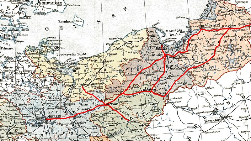
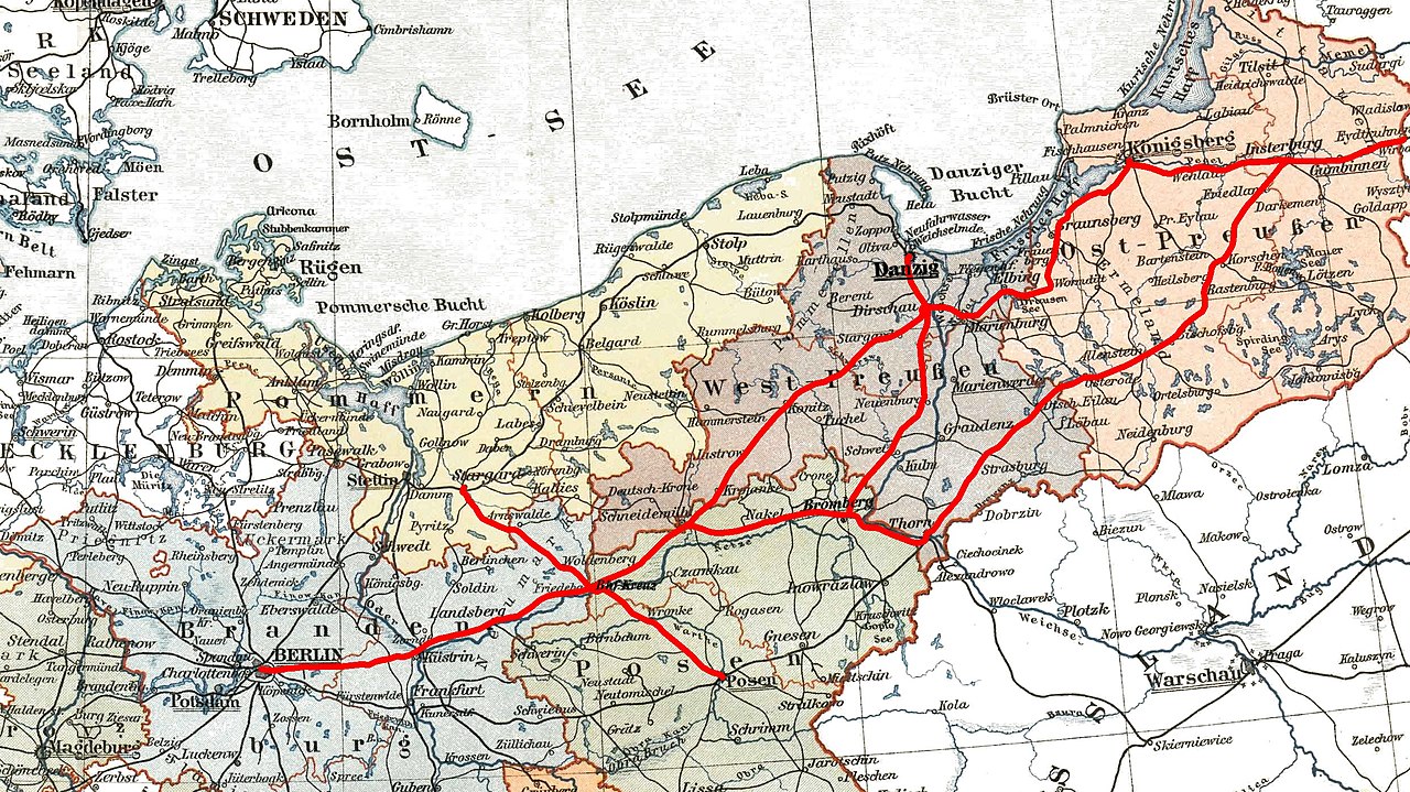
Map of de:Preußische Ostbahn (en:Prussian Eastern Railway) based on "Image:Prussia (political map before 1905).jpg" Image:Prussia (political map before 1905).jpg
.jpg)
| |
This work has been released into the public domain by its author, Pyxlyst, at the English Wikipedia project. This applies worldwide. In case this is not legally possible: |
File history
Click on a date/time to view the file as it appeared at that time.
| Date/Time | Thumbnail | Dimensions | User | Comment | |
|---|---|---|---|---|---|
| current | 15:04, 26 September 2022 | | 2,479 × 1,393 (1.37 MB) | Pyrlandczyk | renewed map, better quality |
| 05:45, 31 July 2007 |  | 1,118 × 522 (281 KB) | Matthead | Map of de:Preußische Ostbahn (en:Prussian Eastern Railway) based on "Image:Prussia (political map before 1905).jpg" [http://commons.wikimedia.org/wiki/Image:Prussia_%28political_map_before_1905%29.jpg] {{PD-user-w|de|German Wikipedia|Pyxlyst}} |
File usage
The following pages on the English Wikipedia use this file (pages on other projects are not listed):
Global file usage
The following other wikis use this file:
- Usage on da.wikipedia.org
- Usage on de.wikipedia.org
- Usage on es.wikipedia.org
- Usage on fr.wikipedia.org
- Usage on it.wikipedia.org
- Usage on ja.wikipedia.org
- Usage on ko.wikipedia.org
- Usage on lt.wikipedia.org
- Usage on no.wikipedia.org
- Usage on pl.wikipedia.org
- Usage on sv.wikipedia.org
- Usage on www.wikidata.org