
File:Kraantje Lek.jpg

Size of this preview: 800 × 533 pixels. Other resolutions: 320 × 213 pixels | 640 × 427 pixels | 1,024 × 683 pixels | 1,280 × 853 pixels | 2,560 × 1,707 pixels | 3,072 × 2,048 pixels.
Original file (3,072 × 2,048 pixels, file size: 3 MB, MIME type: image/jpeg)
| This is a file from the Wikimedia Commons. Information from its description page there is shown below. Commons is a freely licensed media file repository. You can help. |
Summary
| Description |
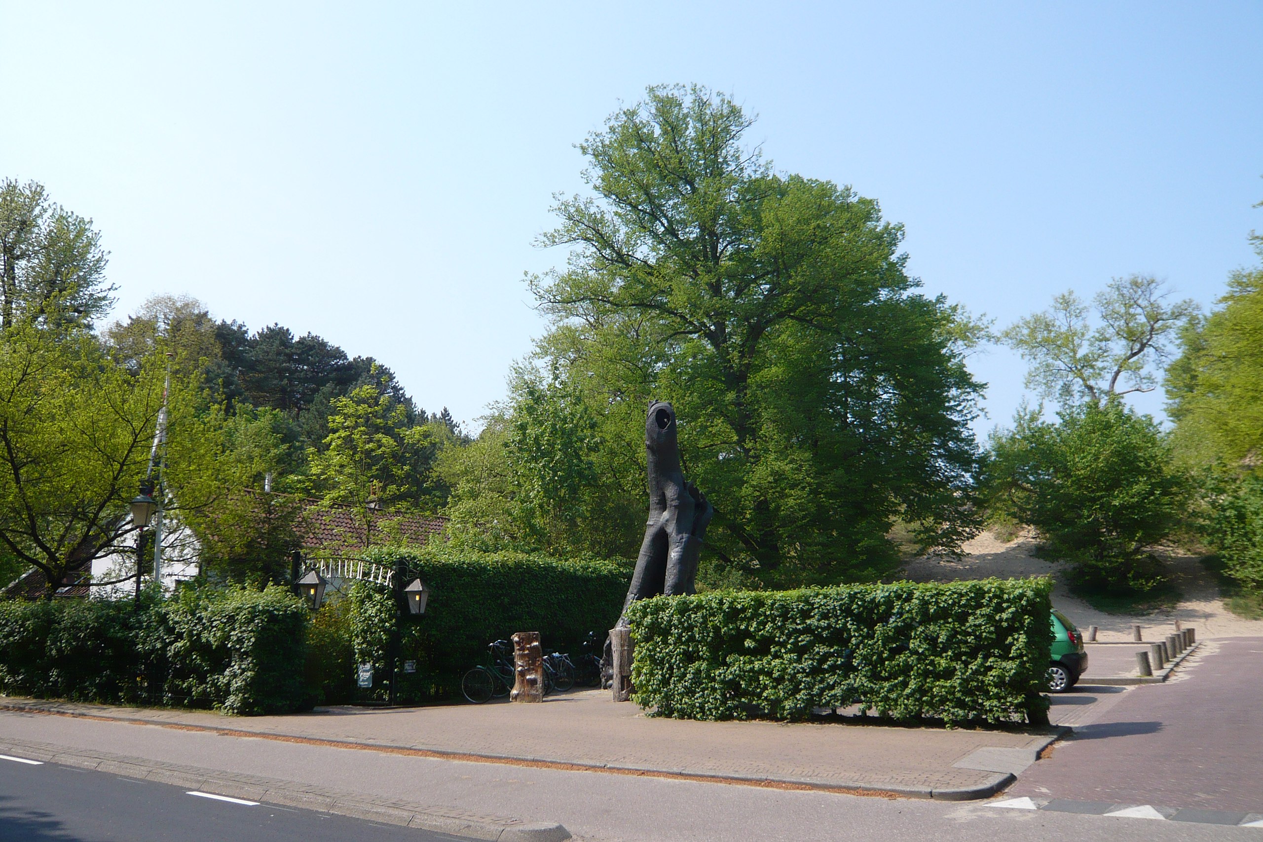
Nederlands: Zicht op een deel van restaurant Kraantje Lek nabij de duintop De Blinkert in Overveen English: Restaurant Kraantje Lek in Overveen, Bloemendaal, the Netherlands. The black sculpture is the tarred over remains of a monumental tree known locally as the "Holle boom" which finally died in the 1990's. Behind the tree a large sand dune can be seen. A flight of stairs takes the visitor to a view of the park Kennemerduinen and the trail "Visserspad". This particular dune is a popular place for various sports clubs in the area who train by running up and down this sand dune and along the trail (which leads to Zandvoort). To the right (not shown) one of three public water fountains at the edge of the dunes park is often used by joggers, cyclists and dog owners in the summer months (during the winter it is turned off).
|
||
| Date | |||
| Source | Own work | ||
| Author | Jane023 |
| Object location | | View this and other nearby images on: OpenStreetMap |
|---|
Licensing
I, the copyright holder of this work, hereby publish it under the following license:
This file is licensed under the Creative Commons Attribution-Share Alike 3.0 Netherlands license.
- You are free:
- to share – to copy, distribute and transmit the work
- to remix – to adapt the work
- Under the following conditions:
- attribution – You must give appropriate credit, provide a link to the license, and indicate if changes were made. You may do so in any reasonable manner, but not in any way that suggests the licensor endorses you or your use.
- share alike – If you remix, transform, or build upon the material, you must distribute your contributions under the same or compatible license as the original.


|
This image was uploaded as part of Wiki Loves Monuments 2011.
|
 |
| Annotations | This image is annotated: View the annotations at Commons |
.jpg)

File history
Click on a date/time to view the file as it appeared at that time.
| Date/Time | Thumbnail | Dimensions | User | Comment | |
|---|---|---|---|---|---|
| current | 19:06, 23 September 2011 | | 3,072 × 2,048 (3 MB) | Jane023 |
File usage
The following pages on the English Wikipedia use this file (pages on other projects are not listed):
Global file usage
The following other wikis use this file:
- Usage on es.wikipedia.org
- Usage on nl.wikipedia.org
- Usage on www.wikidata.org