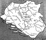
File:Kraljevina Bosna 1391.png

Page contents not supported in other languages.
This is a file from the Wikimedia Commons
From Wikipedia, the free encyclopedia

Original file(1,083 × 1,023 pixels, file size: 945 KB, MIME type: image/png)

Summary

Description
English:
Date
Source Own work
Author BosnaSRB RS
Other versions
Simpler version

From the book, "Naselja srednjovjekovne bosanske države"], Marko Vego, 1. Gl. stv. nasl. a) Bosna i Hercegovina - 20. st. - Historijske karte

From the book, "Teritorijalni razvoj bosanske države u srednjem vijeku", by Vladimir Ćorović
  1. Historijska karta SREDNJEVJEKOVOVNE BOSANSKE DRŽAVE - DIGITALNE KOLEKCIJE (in Bosanski). kolekcije.nub.ba (1957). Retrieved on 10 April 2021.
  2. Historijska karta srednjevjekovne bosanske države / sastavio Marko Vego ; izrada i reprodukcija Geokarta. digitalna.nsk.hr. Digitalne zbirke Nacionalne i sveučilišne knjižnice u Zagrebu. Retrieved on 10 April 2021.
  3. (1935) Teritorijalni razvoj bosanske države u srednjem vijeku, Glas SKA (167)

Licensing

Public domain This work has been released into the public domain by its author, BosnaSRB RS. This applies worldwide.
In some countries this may not be legally possible; if so:
BosnaSRB RS grants anyone the right to use this work for any purpose, without any conditions, unless such conditions are required by law.

Captions

Add a one-line explanation of what this file represents

Items portrayed in this file

depicts

4 May 2015

image/png

File history

Click on a date/time to view the file as it appeared at that time.

Date/TimeThumbnailDimensionsUserComment
current22:13, 2 April 2022Thumbnail for version as of 22:13, 2 April 20221,083 × 1,023 (945 KB)Ранко Николићadd Jagat
13:19, 4 May 2015Thumbnail for version as of 13:19, 4 May 20151,083 × 1,023 (982 KB)MaxtonUser created page with UploadWizard
The following pages on the English Wikipedia use this file (pages on other projects are not listed):

Global file usage

Metadata