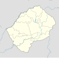
File:Lesotho location map.svg
Appearance

Size of this PNG preview of this SVG file: 512 × 500 pixels. Other resolutions: 246 × 240 pixels | 492 × 480 pixels | 786 × 768 pixels | 1,049 × 1,024 pixels | 2,097 × 2,048 pixels.
Original file (SVG file, nominally 512 × 500 pixels, file size: 103 KB)
File history
Click on a date/time to view the file as it appeared at that time.
| Date/Time | Thumbnail | Dimensions | User | Comment | |
|---|---|---|---|---|---|
| current | 23:57, 9 July 2024 |  | 512 × 500 (103 KB) | Glrx | add sodipodi namespace // Editing SVG source code using c:User:Rillke/SVGedit.js |
| 18:04, 21 October 2013 |  | 1,023 × 1,000 (104 KB) | NordNordWest | corr, see file description | |
| 07:02, 7 March 2010 |  | 1,023 × 1,000 (146 KB) | Spischot | Default size inceased | |
| 20:31, 28 October 2009 |  | 340 × 332 (193 KB) | Spischot | {{Information |Description={{de|Positionskarte von Lesotho}} Quadratische Plattkarte. {{en|Location map of Lesotho}} Equirectangular projection. Geographic limits of the map: * N: 28.33° S * S: 30.89° S * W: 26.74° |
File usage
The following page uses this file:
Global file usage
The following other wikis use this file:
- Usage on ar.wikipedia.org
- Usage on bg.wikipedia.org
- Usage on bn.wikipedia.org
- Usage on bs.wikipedia.org
- Usage on ce.wikipedia.org
- Usage on cs.wikipedia.org
- Usage on de.wikipedia.org
- Usage on el.wikipedia.org
- Usage on eo.wikipedia.org
- Usage on es.wikipedia.org
- Usage on et.wikipedia.org
- Usage on fa.wikipedia.org
- Usage on fi.wikipedia.org
- Usage on he.wikivoyage.org
- Usage on kaa.wikipedia.org
- Usage on ka.wikipedia.org
- Usage on kn.wikipedia.org
- Usage on ko.wikipedia.org
- Usage on lt.wikipedia.org
- Usage on lv.wikipedia.org
- Usage on mk.wikipedia.org
View more global usage of this file.

