
File:Lfmap.gif
Lfmap.gif (603 × 407 pixels, file size: 7 KB, MIME type: image/gif)
| This is a file from the Wikimedia Commons. Information from its description page there is shown below. Commons is a freely licensed media file repository. You can help. |
Summary
| Description |
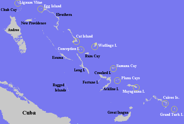
Mapa de las Bahamas señalando las posibles islas que podrían ser Guanahani English: This image made by me, and copyright by me, Keith Pickering (c)1997. I am hereby licensing its use by Wikipedia.org under the GFDL license. This image can also be found at my website, www.columbusnavigation.com/cclandfl.shtml . |
| Date | Keith Pickering (c)1997 |
| Source | http://en.wikipedia.org/wiki/Image:Lfmap.gif |
| Author | Keith Pickering (c)1997 |
| Permission (Reusing this file) |
GDFL |
| Other versions | ааааа |
Licensing
|
NOTE: "subject to disclaimers" below may not actually apply, this was tagged with {{GFDL-user-en}}, and after May 2007, en:Template:GFDL-self did not require disclaimers. Please check the image description page on the English Wikipedia (or, if it has been deleted, ask an English Wikipedia administrator). See Wikipedia:GFDL standardization for details. | ||||||||
Keithpickering at the English-language Wikipedia, the copyright holder of this work, hereby publishes it under the following license:
| ||||||||
|
Note: This tag should not be used. For images that were released on the English Wikipedia using either GFDL or GFDL-self with disclaimers, use {{GFDL-user-en-with-disclaimers}}. For images without disclaimers please use {{GFDL-user-en-no-disclaimers}} instead. If you are the copyright holder of files that were released on Wikipedia, please consider removing the disclaimers. |

File history
Click on a date/time to view the file as it appeared at that time.
| Date/Time | Thumbnail | Dimensions | User | Comment | |
|---|---|---|---|---|---|
| current | 01:12, 18 September 2006 | | 603 × 407 (7 KB) | Roblespepe | {{Information |Description=Mapa de las Bahamas señalando las posibles islas que podrían ser Guanahani |Source=http://en.wikipedia.org/wiki/Image:Lfmap.gif |Date=Keith Pickering (c)1997 |Author=Keith Pickering (c)1997 |Permission=GDFL |other_versions=htt |
File usage
Global file usage
The following other wikis use this file:
- Usage on br.wikipedia.org
- Usage on ca.wikipedia.org
- Usage on eo.wikipedia.org
- Usage on fr.wikipedia.org
- Usage on gl.wikipedia.org
- Usage on pl.wikipedia.org
- Usage on pt.wikipedia.org
- Usage on ru.wikipedia.org
- Usage on zh.wikipedia.org