
File:Limes Rhin.png
Size of this preview: 495 × 599 pixels. Other resolutions: 198 × 240 pixels | 397 × 480 pixels | 748 × 905 pixels.
Original file (748 × 905 pixels, file size: 143 KB, MIME type: image/png)
| This is a file from the Wikimedia Commons. Information from its description page there is shown below. Commons is a freely licensed media file repository. You can help. |
Summary
| Description |
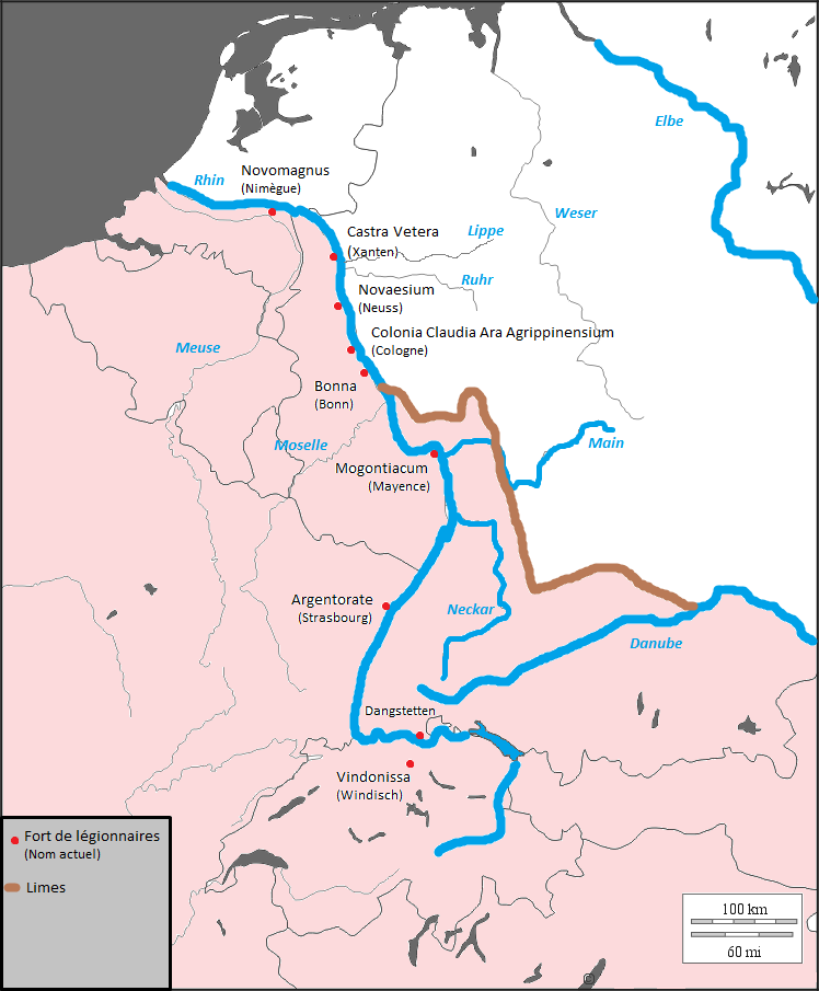
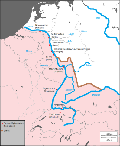
English: Location of the German Limes in connection with the present borders of states
Français : Localisation du Limès germanique en rapport avec les frontières actuelles des états |
| Date | |
| Source | http://histgeo.ac-aix-marseille.fr/webphp/carte.php?num_car=2054&lang=fr |
| Author | Thioneb |
| Permission (Reusing this file) |
Fond provenant du fonds de cartes libres du département d'histoire-géographie de l'académie d'aix-marseille |
Licensing
| I, the copyright holder of this work, release this work into the public domain. This applies worldwide. In some countries this may not be legally possible; if so: I grant anyone the right to use this work for any purpose, without any conditions, unless such conditions are required by law. |
File history
Click on a date/time to view the file as it appeared at that time.
| Date/Time | Thumbnail | Dimensions | User | Comment | |
|---|---|---|---|---|---|
| current | 21:41, 15 March 2009 | | 748 × 905 (143 KB) | Thioneb | Ajout du nom des fleuves |
| 21:22, 15 March 2009 |  | 748 × 905 (138 KB) | Thioneb | {{Information |Description={{en|1=Location of the limes in rhenian region}} {{fr|1=Localisation du limes dans la région rhénane}} |Source=http://histgeo.ac-aix-marseille.fr/webphp/carte.php?num_car=2054&lang=fr |Author=Thioneb |Date=15/03/2009 |Permissi |
File usage
The following pages on the English Wikipedia use this file (pages on other projects are not listed):
Global file usage
The following other wikis use this file:
- Usage on es.wikibooks.org
- Usage on fa.wikipedia.org
- Usage on it.wikipedia.org
- Usage on ko.wikipedia.org
- Usage on ru.wikipedia.org
- Usage on uk.wikipedia.org
- Usage on www.wikidata.org