
File:MSU campus map rev3.png
Size of this preview: 706 × 600 pixels. Other resolutions: 283 × 240 pixels | 565 × 480 pixels | 996 × 846 pixels.
Original file (996 × 846 pixels, file size: 174 KB, MIME type: image/png)
| This is a file from the Wikimedia Commons. Information from its description page there is shown below. Commons is a freely licensed media file repository. You can help. |

|
This map image could be re-created using vector graphics as an SVG file. This has several advantages; see Commons:Media for cleanup for more information. If an SVG form of this image is available, please upload it and afterwards replace this template with
{{vector version available|new image name}}.
It is recommended to name the SVG file “MSU campus map rev3.svg”—then the template Vector version available (or Vva) does not need the new image name parameter. |
Summary
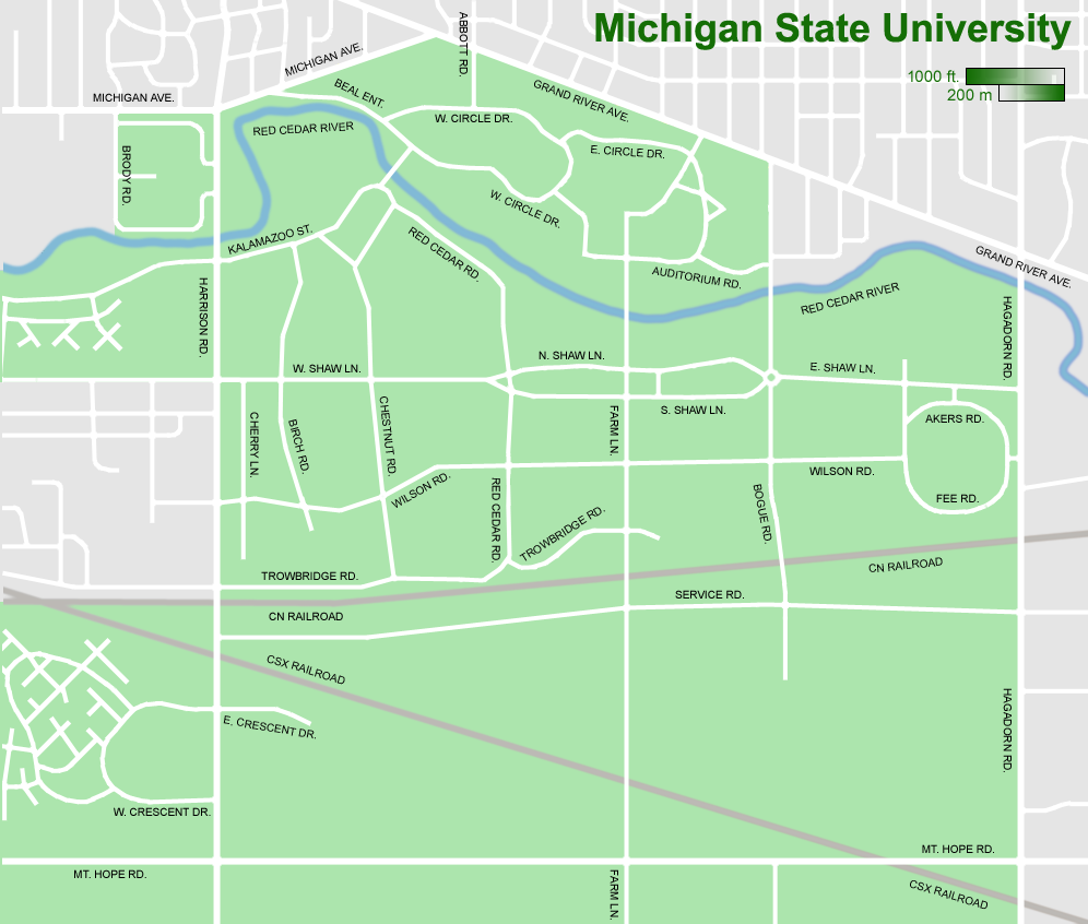
Revision of previous image, MSU_campus_map_rev2.png (2006-2007), which was a revision of MSU_campus_map.png (2005-2006). Changes from 2 to 3 are at Red Cedar & Wilson, West Circle & Auditorium, the removal of Dormitory Road, and the reconfiguration of Auditorium at Bogue (all made in Summer 2007). All revisions back to original made by Shadowlink1014.
THIS REVISION IS VALID BETWEEN AUGUST 2007 AND AUGUST 2008.
Licensing

|
Permission is granted to copy, distribute and/or modify this document under the terms of the GNU Free Documentation License, Version 1.2 or any later version published by the Free Software Foundation; with no Invariant Sections, no Front-Cover Texts, and no Back-Cover Texts. A copy of the license is included in the section entitled GNU Free Documentation License. |
| This file is licensed under the Creative Commons Attribution-Share Alike 3.0 Unported license. | ||
| ||
| This licensing tag was added to this file as part of the GFDL licensing update. |
File history
Click on a date/time to view the file as it appeared at that time.
| Date/Time | Thumbnail | Dimensions | User | Comment | |
|---|---|---|---|---|---|
| current | 06:09, 2 September 2007 | | 996 × 846 (174 KB) | Shadowlink1014~commonswiki | Revision of previous image, MSU_campus_map_rev2.png (2006-2007), which was a revision of MSU_campus_map.png (2005-2006). Changes from 2 to 3 are at Red Cedar & Wilson, West Circle & Auditorium, the removal of Dormitory Road, and the reconfiguration of Aud |
File usage
The following pages on the English Wikipedia use this file (pages on other projects are not listed):
Global file usage
The following other wikis use this file:
- Usage on ar.wikipedia.org
- Usage on azb.wikipedia.org
- Usage on zh.wikipedia.org