Jump to content

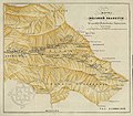
File:Map of Free Svanetia (1855).jpg

Page contents not supported in other languages.
This is a file from the Wikimedia Commons
From Wikipedia, the free encyclopedia

Map_of_Free_Svanetia_(1855).jpg(458 × 399 pixels, file size: 50 KB, MIME type: image/jpeg)

Summary

Description
English: Map of Free Svanetia (1855)
Date
Source Карта Вольно Сванетии к поездке Полковника Бартоломея 1853-го года. Записки Закавказского отдела императорскаго русскаго географическаго общества, книжка III, изданная под редакциею В. А. Вердеревскаго, деиств члена и правителя дел кавказскаго отдела общества Тифлис, 1855. Digitalized by the National Archives of Georgia.
Author Ivan Bartolomei (1813-1870)

Licensing

Public domain

This work is in the public domain in its country of origin and other countries and areas where the copyright term is the author's life plus 70 years or fewer.


You must also include a United States public domain tag to indicate why this work is in the public domain in the United States.

Captions

Add a one-line explanation of what this file represents

Items portrayed in this file

depicts

File history

Click on a date/time to view the file as it appeared at that time.

Date/TimeThumbnailDimensionsUserComment
current19:31, 10 January 2018Thumbnail for version as of 19:31, 10 January 2018458 × 399 (50 KB)KoberUser created page with UploadWizard
The following pages on the English Wikipedia use this file (pages on other projects are not listed):

Global file usage

The following other wikis use this file:

Metadata