
File:Map of Georgia highlighting Crawford County.svg

Size of this PNG preview of this SVG file: 518 × 600 pixels. Other resolutions: 207 × 240 pixels | 414 × 480 pixels | 663 × 768 pixels | 884 × 1,024 pixels | 1,768 × 2,048 pixels | 740 × 857 pixels.
Original file (SVG file, nominally 740 × 857 pixels, file size: 398 KB)
| This is a file from the Wikimedia Commons. Information from its description page there is shown below. Commons is a freely licensed media file repository. You can help. |
Summary
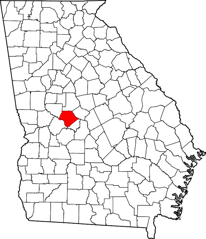
| Description | This is a locator map showing Crawford County in Georgia. For more information, see Commons:United States county locator maps. |
| Source | Public domain map courtesy of The General Libraries, The University of Texas at Austin, modified to show counties. |
| Author | David Benbennick made this map. |
Licensing
| I, the copyright holder of this work, release this work into the public domain. This applies worldwide. In some countries this may not be legally possible; if so: I grant anyone the right to use this work for any purpose, without any conditions, unless such conditions are required by law. |
File history
Click on a date/time to view the file as it appeared at that time.
| Date/Time | Thumbnail | Dimensions | User | Comment | |
|---|---|---|---|---|---|
| current | 13:34, 25 June 2024 | | 740 × 857 (398 KB) | Nux | uniform colors with good contrast |
| 19:15, 19 June 2024 |  | 1,109 × 1,285 (398 KB) | Nux | fix rendering (remove clipping) | |
| 10:58, 12 February 2006 |  | 4,437 × 5,142 (432 KB) | David Benbennick | {{subst:User:Dbenbenn/clm|county=Crawford County|state=Georgia}} |
File usage
The following pages on the English Wikipedia use this file (pages on other projects are not listed):
- Ceres, Georgia
- Crawford County, Georgia
- Francisville, Georgia
- Gaillard, Georgia
- Hammett, Georgia
- Knoxville, Georgia
- Lee Pope, Georgia
- List of census-designated places in Georgia
- List of counties in Georgia
- Musella, Georgia
- Roberta, Georgia
- Zenith, Georgia
- User:Nyttend/County templates/GA/1
- Template:Crawford County, Georgia
- Category:Populated places in Crawford County, Georgia
Global file usage
The following other wikis use this file:
- Usage on ar.wikipedia.org
- Usage on bg.wikipedia.org
- Usage on bpy.wikipedia.org
- Usage on cdo.wikipedia.org
- Usage on ceb.wikipedia.org
- Usage on ce.wikipedia.org
- Usage on cy.wikipedia.org
- Usage on de.wikipedia.org
- Usage on eo.wikipedia.org
- Usage on es.wikipedia.org
- Usage on et.wikipedia.org
- Usage on eu.wikipedia.org
- Usage on fa.wikipedia.org
- Usage on frr.wikipedia.org
- Usage on fr.wikipedia.org
- Usage on ga.wikipedia.org
- Usage on gl.wikipedia.org
- Usage on hu.wikipedia.org
- Usage on hy.wikipedia.org
- Usage on it.wikipedia.org
- Usage on ja.wikipedia.org
- Usage on ko.wikipedia.org
- Usage on la.wikipedia.org
- Usage on lg.wikipedia.org
- Usage on mzn.wikipedia.org
- Usage on nds.wikipedia.org
- Usage on nl.wikipedia.org
- Usage on no.wikipedia.org
- Usage on pl.wikipedia.org
- Usage on ro.wikipedia.org
- Usage on ru.wikipedia.org
- Usage on sh.wikipedia.org
- Usage on simple.wikipedia.org
- Usage on sr.wikipedia.org
- Usage on sv.wikipedia.org
- Usage on tr.wikipedia.org
- Usage on tt.wikipedia.org
- Usage on tum.wikipedia.org
- Usage on uk.wikipedia.org
View more global usage of this file.