
File:Map of OIC.png

Size of this preview: 800 × 400 pixels. Other resolutions: 320 × 160 pixels | 640 × 320 pixels | 1,250 × 625 pixels.
Original file (1,250 × 625 pixels, file size: 40 KB, MIME type: image/png)
| This is a file from the Wikimedia Commons. Information from its description page there is shown below. Commons is a freely licensed media file repository. You can help. |
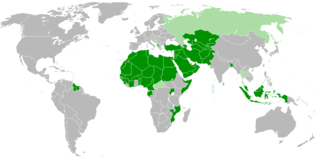
| Description | Members of OIC |
| Date | |
| Source | Own work |
| Author | Myrzic Cyril |
| This work is ineligible for copyright and therefore in the public domain because it consists entirely of information that is common property and contains no original authorship. |
File history
Click on a date/time to view the file as it appeared at that time.
| Date/Time | Thumbnail | Dimensions | User | Comment | |
|---|---|---|---|---|---|
| current | 20:31, 2 February 2018 | | 1,250 × 625 (40 KB) | Maphobbyist | Check |
| 20:26, 2 February 2018 |  | 1,250 × 625 (40 KB) | Maphobbyist | Added borders of South Sudan which became idependent in 2011 and which is not a member of the OIC. | |
| 13:31, 27 August 2008 |  | 1,250 × 625 (55 KB) | Myrzich Cyril | {{Information |Description= |Source= |Date= |Author= |Permission= |other_versions= }} | |
| 12:53, 26 May 2008 |  | 1,250 × 625 (55 KB) | Myrzich Cyril | {{Information |Description= Members of OIC |Source= Собственная работа |Date= may 26, 2008 |Author= Myrzich Cyril |Permission= |other_versions= }} {{PD-ineligible}} Category:Subcontinental maps | |
| 12:31, 26 May 2008 |  | 1,250 × 625 (55 KB) | Myrzich Cyril | {{Information |Description= Members of OIC |Source= Собственная работа |Date= may 26, 2008 |Author= Myrzic Cyril |Permission= |other_versions= }} {{PD-ineligible}} Category:Subcontinental maps |
File usage
The following pages on the English Wikipedia use this file (pages on other projects are not listed):
Global file usage
The following other wikis use this file:
- Usage on be.wikipedia.org
- Usage on es.wikipedia.org
- Usage on fa.wikipedia.org
- Usage on fr.wikipedia.org
- Usage on he.wikipedia.org
- Usage on it.wikipedia.org
- Usage on uk.wikipedia.org