
File:Map of the McMurdo-South Pole highway.jpg
Size of this preview: 718 × 600 pixels. Other resolutions: 287 × 240 pixels | 575 × 480 pixels | 919 × 768 pixels | 1,226 × 1,024 pixels | 1,671 × 1,396 pixels.
Original file (1,671 × 1,396 pixels, file size: 1.13 MB, MIME type: image/jpeg)
| This is a file from the Wikimedia Commons. Information from its description page there is shown below. Commons is a freely licensed media file repository. You can help. |
| Description |
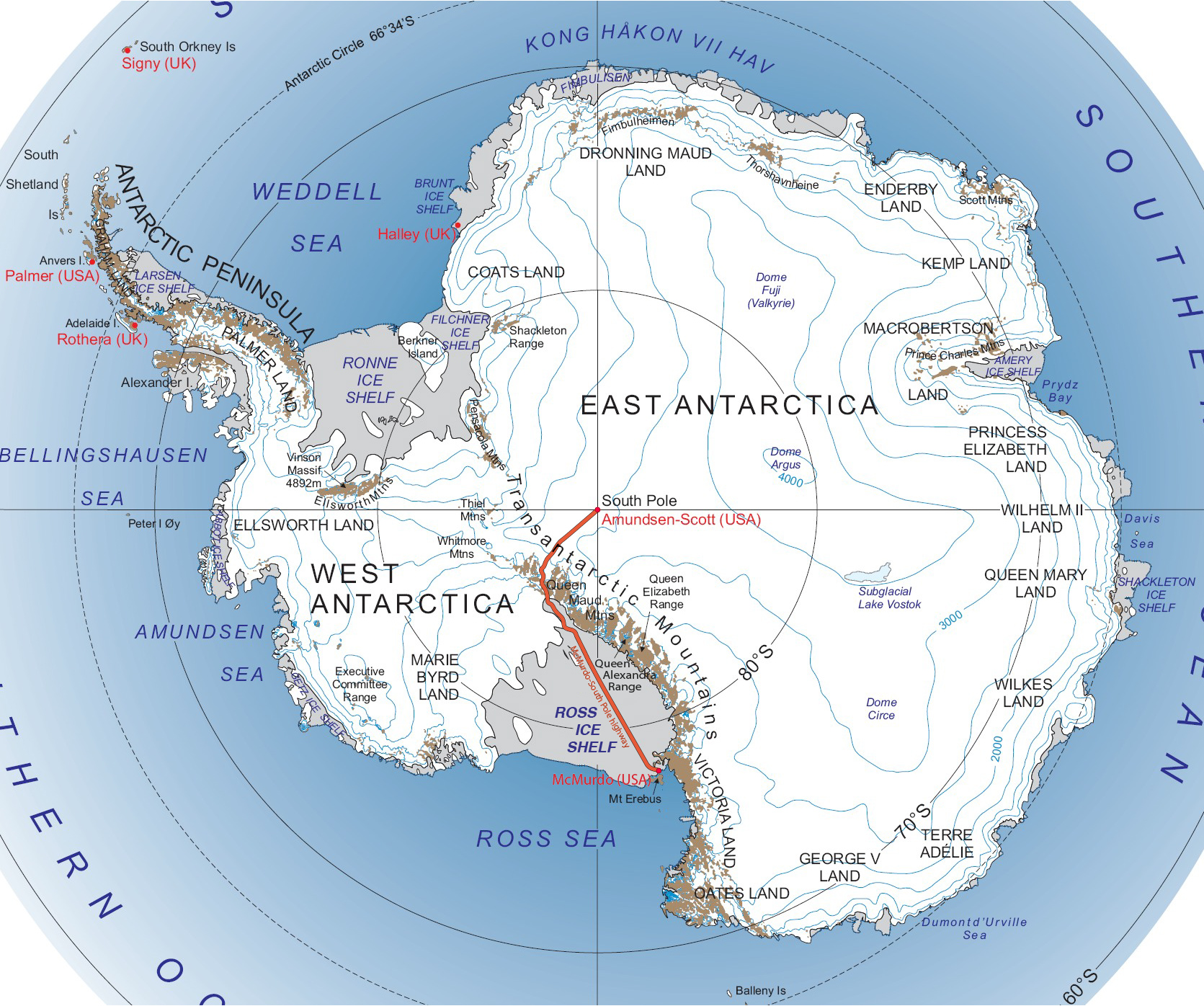
Deutsch: Karte der South Pole Traverse (Südpol-Fernstraße)
English: Map of the South Pole Traverse |
| Date | see file history |
| Source |
own work, using |
| Author | Maximilian Dörrbecker (Chumwa) |
| Permission (Reusing this file) |
I, the copyright holder of this work, hereby publish it under the following license: This file is licensed under the Creative Commons Attribution-Share Alike 2.5 Generic license.
Sie dürfen das Bild zu den folgenden Bedingungen nutzen:
|
File history
Click on a date/time to view the file as it appeared at that time.
| Date/Time | Thumbnail | Dimensions | User | Comment | |
|---|---|---|---|---|---|
| current | 18:41, 21 July 2016 | | 1,671 × 1,396 (1.13 MB) | Chumwa | genauere Route |
| 11:57, 27 September 2009 |  | 1,671 × 1,396 (672 KB) | Chumwa | andere Schriftart und -farbe zur Beschriftung des Ross Ice Shelfs | |
| 08:51, 27 September 2009 |  | 1,671 × 1,396 (670 KB) | Chumwa | some enhancements | |
| 07:42, 27 September 2009 |  | 1,671 × 1,396 (670 KB) | Chumwa | {{Information |Description= {{ de }} Karte der Südpol-Autobahn {{ en }} Map of the McMurdo-South Pole highway |Source=own work, using * this file |Date=see file history |Author= [[:de:User:Chumwa|Maxim |
File usage
The following pages on the English Wikipedia use this file (pages on other projects are not listed):
Global file usage
The following other wikis use this file:
- Usage on az.wikipedia.org
- Usage on bg.wikipedia.org
- Usage on de.wikipedia.org
- Usage on es.wikipedia.org
- Usage on fr.wikipedia.org
- Usage on he.wikipedia.org
- Usage on ja.wikipedia.org
- Usage on lt.wikipedia.org
- Usage on lv.wikipedia.org
- Usage on nl.wikipedia.org
- Usage on no.wikipedia.org
- Usage on pt.wikipedia.org
- Usage on ru.wikipedia.org
- Usage on sv.wikipedia.org
- Usage on uk.wikipedia.org
- Usage on www.wikidata.org
- Usage on zh.wikipedia.org