
File:Map of the Mississippi River & Bonne Terre Railway.jpg
Size of this preview: 400 × 600 pixels. Other resolutions: 160 × 240 pixels | 320 × 480 pixels | 709 × 1,063 pixels.
Original file (709 × 1,063 pixels, file size: 162 KB, MIME type: image/jpeg)
| This is a file from the Wikimedia Commons. Information from its description page there is shown below. Commons is a freely licensed media file repository. You can help. |
Summary
| Description |
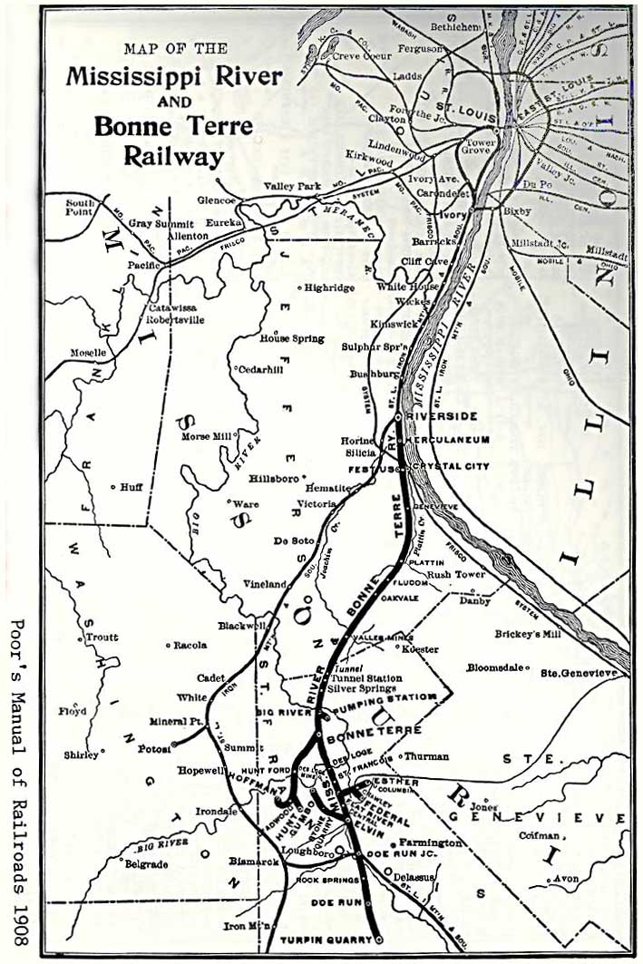
English: Shows the main line and connections of the Mississippi River & Bonne Terre Railway, built to serve lead mines in southeastern Missouri |
| Date | |
| Source | Poor's Manual of Railroads, Volume 37 (1908) |
| Author | Poor's Manual of Railroads, Volume 37 (1908) |
Licensing
This media file is in the public domain in the United States. This applies to U.S. works where the copyright has expired, often because its first publication occurred prior to January 1, 1929, and if not then due to lack of notice or renewal. See this page for further explanation.
|
 | |
 |
This image might not be in the public domain outside of the United States; this especially applies in the countries and areas that do not apply the rule of the shorter term for US works, such as Canada, Mainland China (not Hong Kong or Macao), Germany, Mexico, and Switzerland. The creator and year of publication are essential information and must be provided. See Wikipedia:Public domain and Wikipedia:Copyrights for more details.
|
File history
Click on a date/time to view the file as it appeared at that time.
| Date/Time | Thumbnail | Dimensions | User | Comment | |
|---|---|---|---|---|---|
| current | 12:17, 15 May 2017 | | 709 × 1,063 (162 KB) | Rafael Zink | rotated verticaly, cropped, color correction |
| 14:45, 17 March 2016 |  | 700 × 1,089 (177 KB) | PRRfan | User created page with UploadWizard |
File usage
The following pages on the English Wikipedia use this file (pages on other projects are not listed):
Global file usage
The following other wikis use this file:
- Usage on de.wikipedia.org