
File:Metropolregion Rhein-Ruhr.png
Original file (2,000 × 2,647 pixels, file size: 1.38 MB, MIME type: image/png)
| This is a file from the Wikimedia Commons. Information from its description page there is shown below. Commons is a freely licensed media file repository. You can help. |
Summary
| Description |
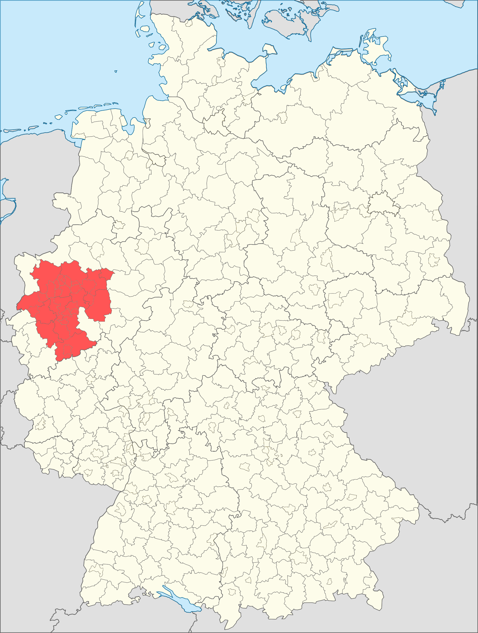
Esperanto: situo de la metropola regiono Rejno-Ruhr (ruĝe) ene de Germanio kun membraj distriktoj kaj eksterdistriktaj urboj
Deutsch: Lage der Metropolregion Rhein-Ruhr (rot) in Deutschland mit beteiligten Landkreisen und kreisfreien Städten |
||
| Date | |||
| Source | Own work | ||
| Author | Thomas Pusch | ||
| Other versions |
file:Metropolregion Rhein-Ruhr grau.png (grau / grize / grey)
|

unter Benutzung von Informationen aus / uzante informojn el / using information of
- file:Landkreise, Kreise und kreisfreie Städte in Deutschland 2011-09-04.svg +
- file:Deutschland Metropolregionen.png
Anmerkung:
Diese Karte und die vorherige Übersichtskarte file:Deutschland Metropolregionen.png sind etwas vereinfacht dahingehend, dass die beteiligten Landkreise und kreisfreien Städte der Metropolregion Rhein-Ruhr markiert sind. In einigen beteiligten Landkreisen sind aber nicht ausnahmslos alle Gemeinden Mitglied der Metropolregion, sodass eine graphische Detailaufschlüsselung nach jeder einzelnen Mitgliedsgemeinde eine etwas schlankere Silhouette der Region ergeben würde. Hinreichend präzise graphische Informationen dafür liegen aber momentan nicht vor, sodass die schematische Vereinfachung der Karte in Kauf genommen wird. Ein Pluspunkt dieser vorliegenden Karte ist dafür, dass sämtliche Kreisgrenzen in Deutschland dem aktuellen Stand von Oktober 2013 entsprechen (auch wenn die letzte Kreisgrenzenänderung von September 2011 "nur" Mecklenburg-Vorpommern betraf, weit weg von der Region Rhein-Ruhr, um die es hier geht - trotzdem ist es sinnvoll, wenn schon alle Kreisgrenzen in Deutschland abgebildet sind, auch den bundesweit aktuellen Stand anzugeben).
Licensing
- You are free:
- to share – to copy, distribute and transmit the work
- to remix – to adapt the work
- Under the following conditions:
- attribution – You must give appropriate credit, provide a link to the license, and indicate if changes were made. You may do so in any reasonable manner, but not in any way that suggests the licensor endorses you or your use.
- share alike – If you remix, transform, or build upon the material, you must distribute your contributions under the same or compatible license as the original.
File history
Click on a date/time to view the file as it appeared at that time.
| Date/Time | Thumbnail | Dimensions | User | Comment | |
|---|---|---|---|---|---|
| current | 22:06, 22 October 2013 | | 2,000 × 2,647 (1.38 MB) | ThomasPusch | User created page with UploadWizard |
File usage
Global file usage
The following other wikis use this file:
- Usage on ban.wikipedia.org
- Usage on cs.wikipedia.org
- Usage on de.wikipedia.org
- Usage on eo.wikipedia.org
- Usage on frr.wikipedia.org
- Usage on sk.wikipedia.org