
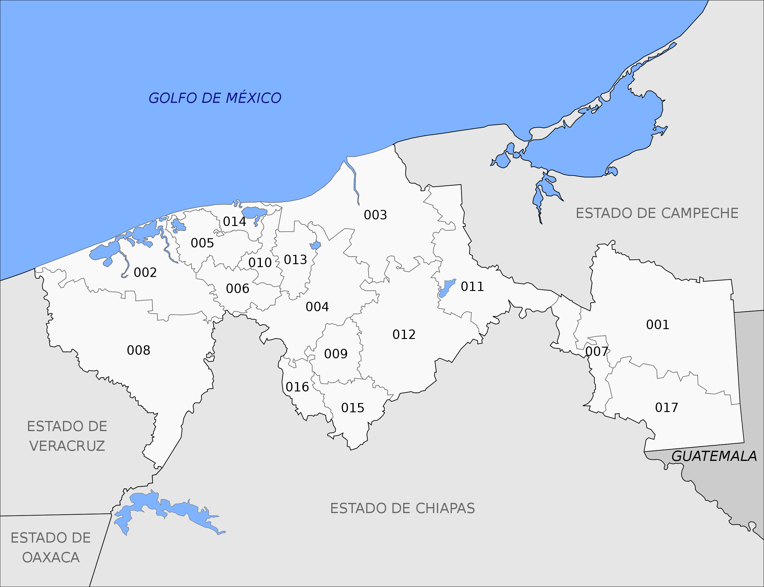
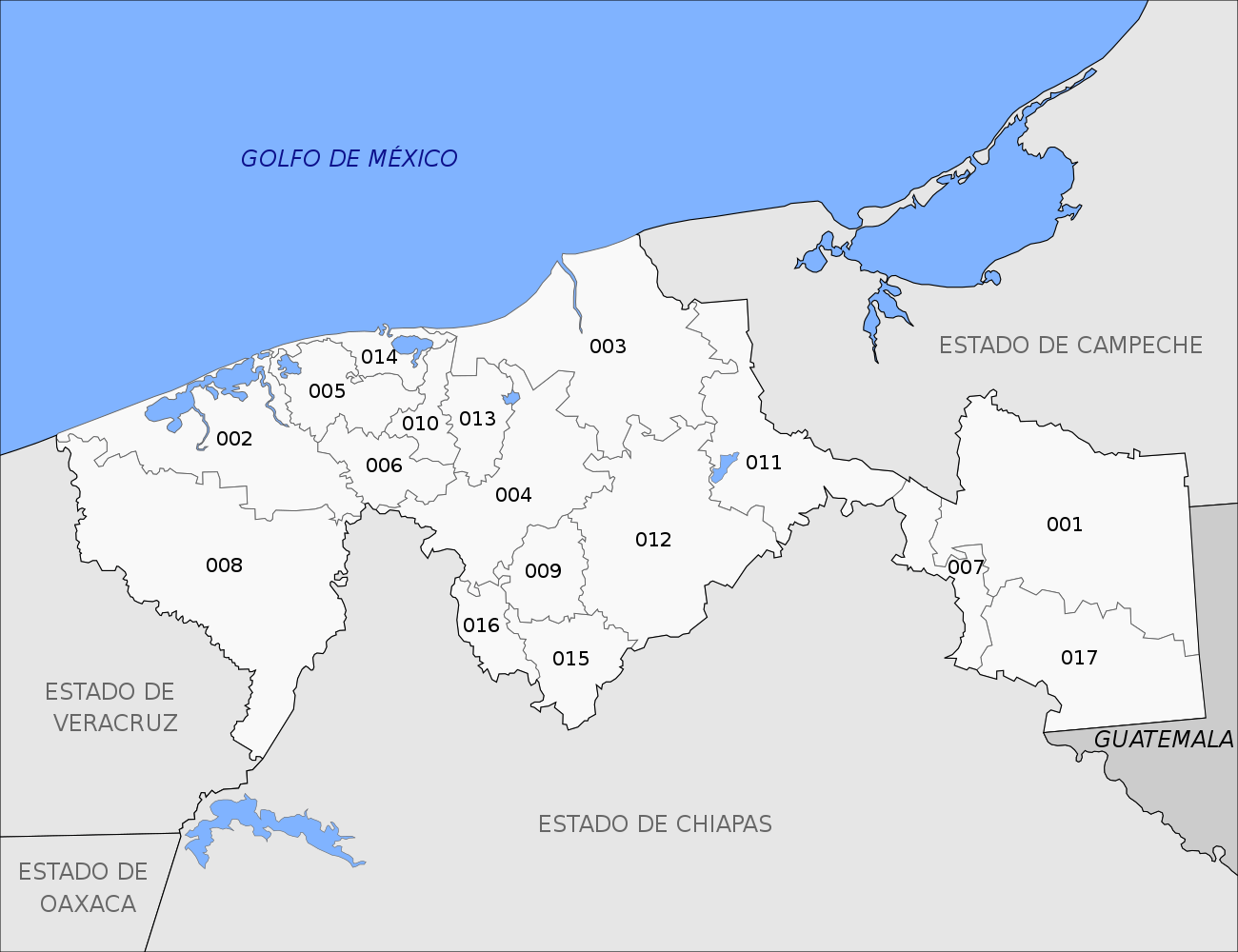
File:Municipios de Tabasco.svg

Size of this PNG preview of this SVG file: 780 × 600 pixels. Other resolutions: 312 × 240 pixels | 624 × 480 pixels | 999 × 768 pixels | 1,280 × 985 pixels | 2,560 × 1,969 pixels | 1,300 × 1,000 pixels.
Original file (SVG file, nominally 1,300 × 1,000 pixels, file size: 95 KB)
| This is a file from the Wikimedia Commons. Information from its description page there is shown below. Commons is a freely licensed media file repository. You can help. |
Summary
| Description |
Español: Mapa de los municipios del estado mexicano de Tabasco.
Русский: Карта муниципалитетов мексиканского штата Табаско.
English: Map of the municipalities of the mexican state of Tabasco. |
| Date | |
| Source | Own work, based on Panorama sociodemográfico de Tabasco. Censo de Población y Vivienda 2020 |
| Author | MikSed |
| Permission (Reusing this file) |
I, the copyright holder of this work, hereby publish it under the following license: This file is licensed under the Creative Commons Attribution-Share Alike 4.0 International license.
|
This W3C-unspecified vector image was created with Inkscape .
File history
Click on a date/time to view the file as it appeared at that time.
| Date/Time | Thumbnail | Dimensions | User | Comment | |
|---|---|---|---|---|---|
| current | 06:35, 14 December 2022 | | 1,300 × 1,000 (95 KB) | MikSed | updated, brought to a unified form. |
| 23:46, 29 April 2012 |  | 1,050 × 626 (308 KB) | Addicted04 | objeto a trazo | |
| 23:42, 29 April 2012 |  | 1,050 × 626 (182 KB) | Addicted04 | new standar map | |
| 06:13, 18 January 2009 |  | 1,184 × 1,062 (428 KB) | Battroid | == Summary == {{Information |Description=Mapa de los municipios del estado de Tabasco en México |Source=self-made {{Inkscape}} |Date=January 17, 2009 |Author= Battroid |Permission={{PD-self}} |other_versions= }} [[Category:Locator maps | |
| 08:00, 20 August 2008 |  | 1,184 × 1,062 (285 KB) | Battroid | == Summary == {{Information |Description=Mapa de los municipios del estado de Tabasco en México |Source=self-made {{Inkscape}} |Date=August 20, 2008 |Author= Battroid |Permission={{PD-self}} |other_versions= }} [[Category:Maps of Tabas |
File usage
No pages on the English Wikipedia use this file (pages on other projects are not listed).
Global file usage
The following other wikis use this file:
- Usage on ca.wikipedia.org
- Usage on de.wikipedia.org
- Usage on eo.wikipedia.org
- Usage on es.wikipedia.org
- Usage on fr.wikipedia.org
- Usage on it.wikipedia.org
- Usage on ru.wikipedia.org