
File:New Footbridge, near Granby, Nottinghamshire - geograph.org.uk - 64074.jpg
No higher resolution available.
New_Footbridge,_near_Granby,_Nottinghamshire_-_geograph.org.uk_-_64074.jpg (640 × 480 pixels, file size: 164 KB, MIME type: image/jpeg)
| This is a file from the Wikimedia Commons. Information from its description page there is shown below. Commons is a freely licensed media file repository. You can help. |
Summary
| Description |
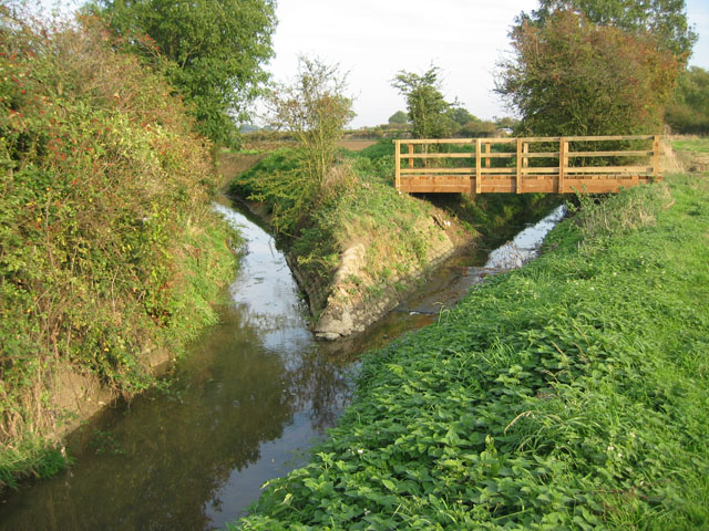
English: New Footbridge, near Granby, Nottinghamshire. This brand new footbridge takes the public footpath across the Rundle Beck where it joins The Grimmer. The resulting stream is known as the River Whipling a few km further down stream. This clearly shows how important the network of streams are for draining the heavy clay soils of the Vale of Belvoir. After a period of heavy rain the water level can be nearing the top of the bank. |
| Date | |
| Source | From geograph.org.uk |
| Author | Kate Jewell |
| Attribution (required by the license) | Kate Jewell / New Footbridge, near Granby, Nottinghamshire / |
| Camera location | | View this and other nearby images on: OpenStreetMap |
|---|
_heading:90.00&language=en)
| Object location | | View this and other nearby images on: OpenStreetMap |
|---|
_heading:90.00&language=en)
Licensing

|
This image was taken from the Geograph project collection. See this photograph's page on the Geograph website for the photographer's contact details. The copyright on this image is owned by Kate Jewell and is licensed for reuse under the Creative Commons Attribution-ShareAlike 2.0 license.
|
This file is licensed under the Creative Commons Attribution-Share Alike 2.0 Generic license.
Attribution: Kate Jewell
- You are free:
- to share – to copy, distribute and transmit the work
- to remix – to adapt the work
- Under the following conditions:
- attribution – You must give appropriate credit, provide a link to the license, and indicate if changes were made. You may do so in any reasonable manner, but not in any way that suggests the licensor endorses you or your use.
- share alike – If you remix, transform, or build upon the material, you must distribute your contributions under the same or compatible license as the original.
File history
Click on a date/time to view the file as it appeared at that time.
| Date/Time | Thumbnail | Dimensions | User | Comment | |
|---|---|---|---|---|---|
| current | 17:20, 30 January 2010 | | 640 × 480 (164 KB) | GeographBot | == {{int:filedesc}} == {{Information |description={{en|1=New Footbridge, near Granby, Nottinghamshire. This brand new footbridge takes the public footpath across the Rundle Beck where it joins The Grimmer. The resulting stream is known as the River Whipli |
File usage
The following pages on the English Wikipedia use this file (pages on other projects are not listed):