
File:Newcastle - Blackhill local train at Low Fell, 1946 (geograph 4975783).jpg
Size of this preview: 800 × 430 pixels. Other resolutions: 320 × 172 pixels | 640 × 344 pixels | 1,024 × 550 pixels | 1,280 × 687 pixels | 2,352 × 1,263 pixels.
Original file (2,352 × 1,263 pixels, file size: 1.17 MB, MIME type: image/jpeg)
| This is a file from the Wikimedia Commons. Information from its description page there is shown below. Commons is a freely licensed media file repository. You can help. |
.jpg)
Summary
| Description |
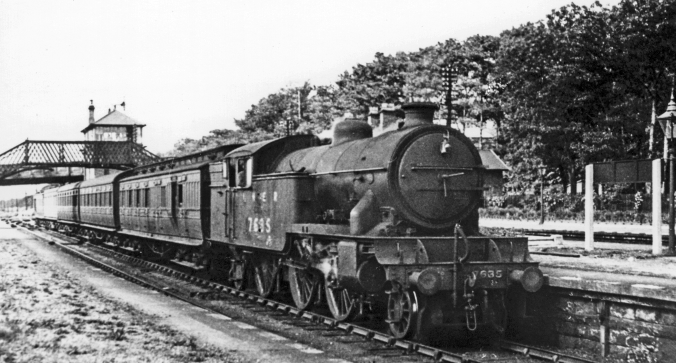
English: Newcastle - Blackhill local train at Low Fell, 1946 View northward on the ex-NER ECML, towards Newcastle. The locomotive is Gresley V1 class 2-6-2T No. 7635, recently renumbered from its number 446 when built 4/35; as BR No. 67635 it lasted until 9/63. |
| Date | |
| Source | From geograph.org.uk |
| Author | Walter Dendy, deceased |
| Permission (Reusing this file) |
Creative Commons Attribution Share-alike license 2.0 |
| Attribution (required by the license) | Walter Dendy, deceased / Newcastle - Blackhill local train at Low Fell, 1946 / |
| Camera location | | View this and other nearby images on: OpenStreetMap |
|---|
.jpg¶ms=054.933147_N_-001.608719_E_globe:Earth_type:camera_heading:0.00_source:geograph&language=en)
| Object location | | View this and other nearby images on: OpenStreetMap |
|---|
.jpg¶ms=054.933190_N_-001.608600_E_globe:Earth_class:object_type:object_source:geograph-osgb36(NZ25175990)_region:GB-GBN_heading:0.00&language=en)
Licensing

|
This image was taken from the Geograph project collection. See this photograph's page on the Geograph website for the photographer's contact details. The copyright on this image is owned by Walter Dendy, deceased and is licensed for reuse under the Creative Commons Attribution-ShareAlike 2.0 license.
|
This file is licensed under the Creative Commons Attribution-Share Alike 2.0 Generic license.
Attribution: Walter Dendy, deceased
- You are free:
- to share – to copy, distribute and transmit the work
- to remix – to adapt the work
- Under the following conditions:
- attribution – You must give appropriate credit, provide a link to the license, and indicate if changes were made. You may do so in any reasonable manner, but not in any way that suggests the licensor endorses you or your use.
- share alike – If you remix, transform, or build upon the material, you must distribute your contributions under the same or compatible license as the original.
File history
Click on a date/time to view the file as it appeared at that time.
| Date/Time | Thumbnail | Dimensions | User | Comment | |
|---|---|---|---|---|---|
| current | 19:14, 31 July 2017 | | 2,352 × 1,263 (1.17 MB) | Das48 | Transferred from geograph.co.uk using [https://tools.wmflabs.org/geograph2commons/ geograph2commons] |
File usage
The following pages on the English Wikipedia use this file (pages on other projects are not listed):
Global file usage
The following other wikis use this file:
- Usage on www.wikidata.org
.jpg)