
File:Old Tavern, Machias, ME.jpg
No higher resolution available.
Old_Tavern,_Machias,_ME.jpg (661 × 399 pixels, file size: 77 KB, MIME type: image/jpeg)
| This is a file from the Wikimedia Commons. Information from its description page there is shown below. Commons is a freely licensed media file repository. You can help. |
Summary
|
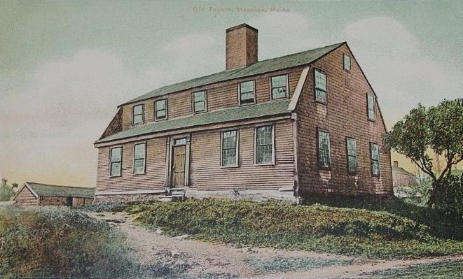
This is an image of a place or building that is listed on the National Register of Historic Places in the United States of America. Its reference number is 73000152. |
| Description |
English: Burnham Tavern, Machias, Maine. Now the Burnham Tavern Museum, it was built in 1770 |
| Date | |
| Source | Reproduced from an original postcard published by G. W. Morris, Portland, Maine |
| Author | Unknown photographer |
| Permission (Reusing this file) |
PD-US |
| Object location | | View this and other nearby images on: OpenStreetMap |
|---|
Licensing
This media file is in the public domain in the United States. This applies to U.S. works where the copyright has expired, often because its first publication occurred prior to January 1, 1929, and if not then due to lack of notice or renewal. See this page for further explanation.
|
 | |
 |
This image might not be in the public domain outside of the United States; this especially applies in the countries and areas that do not apply the rule of the shorter term for US works, such as Canada, Mainland China (not Hong Kong or Macao), Germany, Mexico, and Switzerland. The creator and year of publication are essential information and must be provided. See Wikipedia:Public domain and Wikipedia:Copyrights for more details.
|
Original upload log
The original description page was here. All following user names refer to en.wikipedia.
- 2008-05-25 15:52 Hugh Manatee 661×399× (78653 bytes) Burnham Tavern, Machias, ME; from a 1911 postcard published by G. W. Morris, Portland, Maine. Now the Burnham Tavern Museum, it was built in 1770.
File history
Click on a date/time to view the file as it appeared at that time.
| Date/Time | Thumbnail | Dimensions | User | Comment | |
|---|---|---|---|---|---|
| current | 07:09, 5 June 2012 | | 661 × 399 (77 KB) | File Upload Bot (Magnus Manske) | Transfered from en.wikipedia by User:pauk using CommonsHelper |
File usage
The following pages on the English Wikipedia use this file (pages on other projects are not listed):
Global file usage
The following other wikis use this file:
- Usage on ja.wikipedia.org
- Usage on www.wikidata.org