
File:One 1952-02-04 weather map.png
Size of this preview: 796 × 600 pixels. Other resolutions: 319 × 240 pixels | 637 × 480 pixels | 876 × 660 pixels.
Original file (876 × 660 pixels, file size: 1,019 KB, MIME type: image/png)
| This is a file from the Wikimedia Commons. Information from its description page there is shown below. Commons is a freely licensed media file repository. You can help. |
Summary
| Description |
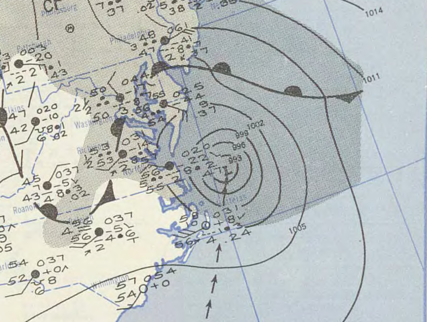
English: Surface weather analysis of 1952 Groundhog Day tropical storm on 4 February 1952 as an extratropical storm off the East Coast. |
|||
| Date | ||||
| Source | NOAA Central Library Data Imaging Project | |||
| Author | NOAA Central Library, Silver Spring, Maryland | |||
| Permission (Reusing this file) |
|
File history
Click on a date/time to view the file as it appeared at that time.
| Date/Time | Thumbnail | Dimensions | User | Comment | |
|---|---|---|---|---|---|
| current | 23:27, 29 December 2010 | | 876 × 660 (1,019 KB) | Marcusmax | {{Information |Description={{en|1=Pressure map showing the Groundhog Day Tropical Storm of 1952 as an extra-tropical storm off of the Eastern Seaboard.}} |Source=http://docs.lib.noaa.gov/rescue/dwm/1952/ |Author=U.S. Weather Bureau |Date=1952-02-04 |Permi |
File usage
The following pages on the English Wikipedia use this file (pages on other projects are not listed):
Global file usage
The following other wikis use this file:
- Usage on pt.wikipedia.org
- Usage on zh.wikipedia.org